
Client Name
Peterson Contractors
Client Type
Project Type
Services Provided
- Construction Staking
- Preliminary DOT Surveys
- Topographic Survey & Subsurface Utility Engineering
Project Manager

Spring Flooding Causes Severe Roadway Damage
Interstate 680 is an important traffic corridor located north of Council Bluffs, Iowa. A key section of this interstate connects I-80 in Nebraska with I-29 in Iowa and crosses the Missouri River via the Mormon Bridge. The route carries approximately 17,400 vehicles per day and serves as a northern bypass of Omaha, Nebraska, and Council Bluffs, Iowa. It also provides critical access to the Omaha airport.
In the winter of 2010/11, the upper Missouri River basin received heavy snowfall. As the snowpack began to melt, the overland flow was higher than normal. On May 23, 2011, eight inches of rain fell in the upper reaches of the basin, further intensifying the high amount of runoff already present. As a result, severe flooding occurred along the Missouri River.
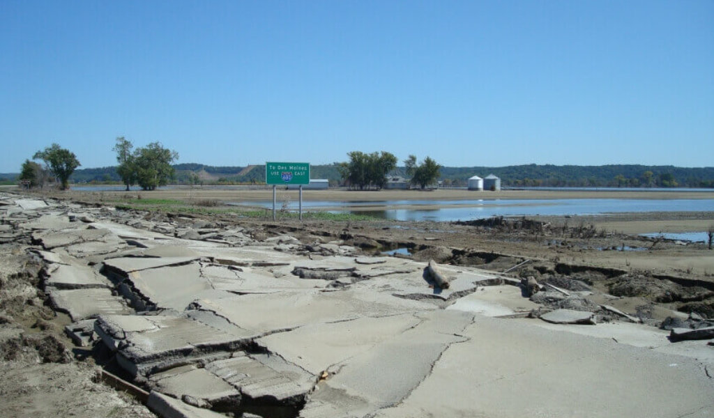
Property and infrastructure damage plagued the area. The pavement on I-680 east of the Mormon Bridge was completely destroyed, and what remained showed signs of floodwater erosion. Eastbound lanes were higher than westbound lanes. Ditches were left full of soil and flood debris. Numerous washouts under the pavement left unknown voids. Total roadway replacement was the only solution.
Emergency Roadway Repair Initiated for I-680
Emergency road repair of I-680 was essential to restore traffic, support regional recovery efforts, minimize the extent of damage, and protect what remained. The Iowa DOT and Federal Highway Administration (FHWA) worked together to procure Emergency Relief funding for the project. Under FHWA Emergency Relief rules, repairs must be done within 180 days after an emergency, further expediting the roadway repair process.
Floodwaters finally receded in September 2011, almost four months after flooding began. This left only two months to complete environmental permitting, survey, highway design, and reconstruction before the FHWA due date for Emergency Relief funding.
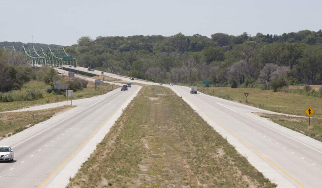
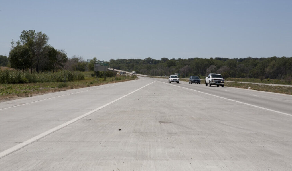
Rebuilding the road involved 2.6 miles of mainline reconstruction and .8 miles of interchange ramp reconstruction.
The entire project was let by the Iowa DOT as a single lump sum to guide rapid completion. The prime contractor, Peterson Contractors, Inc., entrusted Snyder & Associates to perform highway design and construction staking while they rebuilt the flood-ravaged interstate highway.
Reconstruction efforts began the day after the project was awarded and continued 24/7 for the majority of the project’s lifespan.
Emergency Road Reconstruction: Design with Limited Land Survey
Snyder & Associates’ scope of work included limited topographic survey, formulation of a stormwater pollution prevention plan and NPDES permitting, design, construction staking, and record drawings.
The flood destroyed most of the existing pavement, so a full topographic survey wasn’t performed. However, a limited survey was obtained from the remaining pavement. A field survey of remaining alignment monuments was also done to help establish the centerline.
The lack of topographic survey and horizontal/vertical control was challenging. The Iowa DOT provided an alignment and vertical profile of the roadway based on their records. Much of this information needed to be modified to match actual field conditions. Pavement design and typical sections were also provided by the Iowa DOT.
We reviewed the record drawing information provided by the DOT and married it with available LiDAR modeling. The surface model was checked against vertical and horizontal information provided in the record drawings by focusing on known elevations such as culvert flowlines and pavement profiles.
Another challenge was to provide a design that matched the original roadway while upgrading the facility’s geometry to current standards. This was especially difficult on interchange entry and exit ramps. To overcome this challenge, we reconstructed further interchange ramps to accommodate modern geometry, as needed. There was also a curve on I-680 where the elevation standards had changed, so we modified the ditch drainage design to meet the new elevation.
Phased Design for Emergency Roadway Repair
Working closely with the contractor contributed greatly to the project’s success. The design of the roadway corridor was done in phases, beginning with the westbound subgrade, and driven by the contractor’s progress in the field. As the contractor worked around the clock, we adjusted our schedule to stay ahead of them.
The project design was performed and delivered mainly through electronic files to the contractor. Deliverables were patterned around contracting needs to avoid construction delays. Certain parts of the design were plotted for the construction team and DOT inspection staff to convey the design intent. For example, the pavement jointing plans were delivered in this manner, but the bulk of the paper plans and record drawings were done after construction.
There were a few times that the contractor changed the priority of our next deliverable due to unexpected site conditions discovered in the field as reconstruction progressed. We adjusted accordingly by anticipating their needs and working ahead of our own schedule.
Maximizing Technology Use to Guide Roadway Design Success
A variety of technology was used to successfully complete the project including LiDAR surfacing, 3D modeling, GPS-enabled construction equipment, and computer-aided design software.
Most notably, the construction team utilized computer software to perform the design and create 3D files for use in the field. Using this technology allowed us to deliver the project more quickly. Typically, it’s the contractor’s responsibility to convert paper plans into electronic designs. The close working relationship between us and the contractor eliminated any chance of error in converting the plans from paper to electronic.
Expedited Roadway Reconstruction Garners Multiple Awards

Repair on an I-680 Ramp that was Severely Damaged by Flooding in Spring 2011.
The weather was a major concern, but due to unseasonably dry, warm fall weather, construction progressed smoothly. The road was rebuilt on the same footprint as the original road built in the 1960s to minimize environmental issues.
Snyder & Associates played a vital role in the emergency reconstruction of I-680. With the limited topographic survey, LiDAR surfacing, and 35-year-old record drawings, our team was able to recreate the horizontal and vertical control, design the roadway, generate 3D stakeless grading files for each construction phase, and stake the entire corridor for drainage and paving in just over three weeks.
Our project team was comprised entirely of subject matter experts, specializing in project-specific tasks. Over the course of the project, this 12-member team of engineers, technicians, and surveyors worked over 1,680 hours in 34 days. The majority of Snyder’s contribution was complete in 21 days, while construction staking carried through to 34 days.
The road opened to traffic on November 2, 2011, following a ribbon-cutting ceremony. All but $2 million of the $19 million costs was eligible for emergency funding assistance from the FHWA.
It was an honor to work alongside the Iowa DOT and our construction partners, which included Peterson Contractors and Reilly Construction, to rebuild I-680. Since its completion, the project has received a variety of awards and recognition:
- 2012 Roads & Bridges Magazine: Top 10 Roadway Projects in the U.S.
- 2012 America’s Transportation Award: Top 10 Road Project in the U.S., regional winner in the “ahead of schedule” category
- 2013 ACEC Iowa: Engineering Excellence Grand Place