Benefits of Using 3D Modeling in Transportation Engineering
Three-dimensional (3D) modeling techniques used in the design process are a mature concept in the transportation engineering profession. The evolution of 3D modeling has served as the central conduit for shaping the modern-day digital jobsite. As 3D engineering software continues to improve, the benefits of 3D modeling in construction continue to expand, allowing for faster, more accurate, and more efficient planning and construction. From land survey work to Subsurface Utility Engineering (SUE) to construction inspection, plans created in 3D have far-reaching advantages for almost every aspect of a project.
Simply put, a 3D engineered model is a digital graphical representation of proposed project data that utilizes X, Y, and Z coordinates for producing objects in three dimensions. This method better communicates design intent through enhanced visualization, analysis, animation, simulations, and plans. Because the objects in a 3D model are spatially related, they can be viewed from multiple perspectives, allowing the designer to more easily identify design and constructability concerns before the design reaches the field.
Three-dimensional engineered models are the result of extensive survey, design, and coordination to develop a computerized model that accurately represents the existing site conditions and the intent of the designer. After the base mapping, SUE data, and topographic survey data have all been gathered, these data are merged into a comprehensive existing-conditions 3D model for use by the designer. The resultant 3D engineered model can then be utilized by numerous downstream users, including contractors, regulatory agencies, utility companies, and facilities managers, just to name a few.
Through the use of 3D modeling software, design, and construction teams can also connect virtually to develop, test, and amend project plans throughout the design and construction phases. Detailed design features can be viewed geospatially, simulations can be run to detect design flaws before construction begins, and data exported from the 3D models can facilitate the use of Automated Machine Guidance (AMG) during construction (more on this later).
Boosting Engineering Project Efficiencies & Construction Deliverables with 3D Models

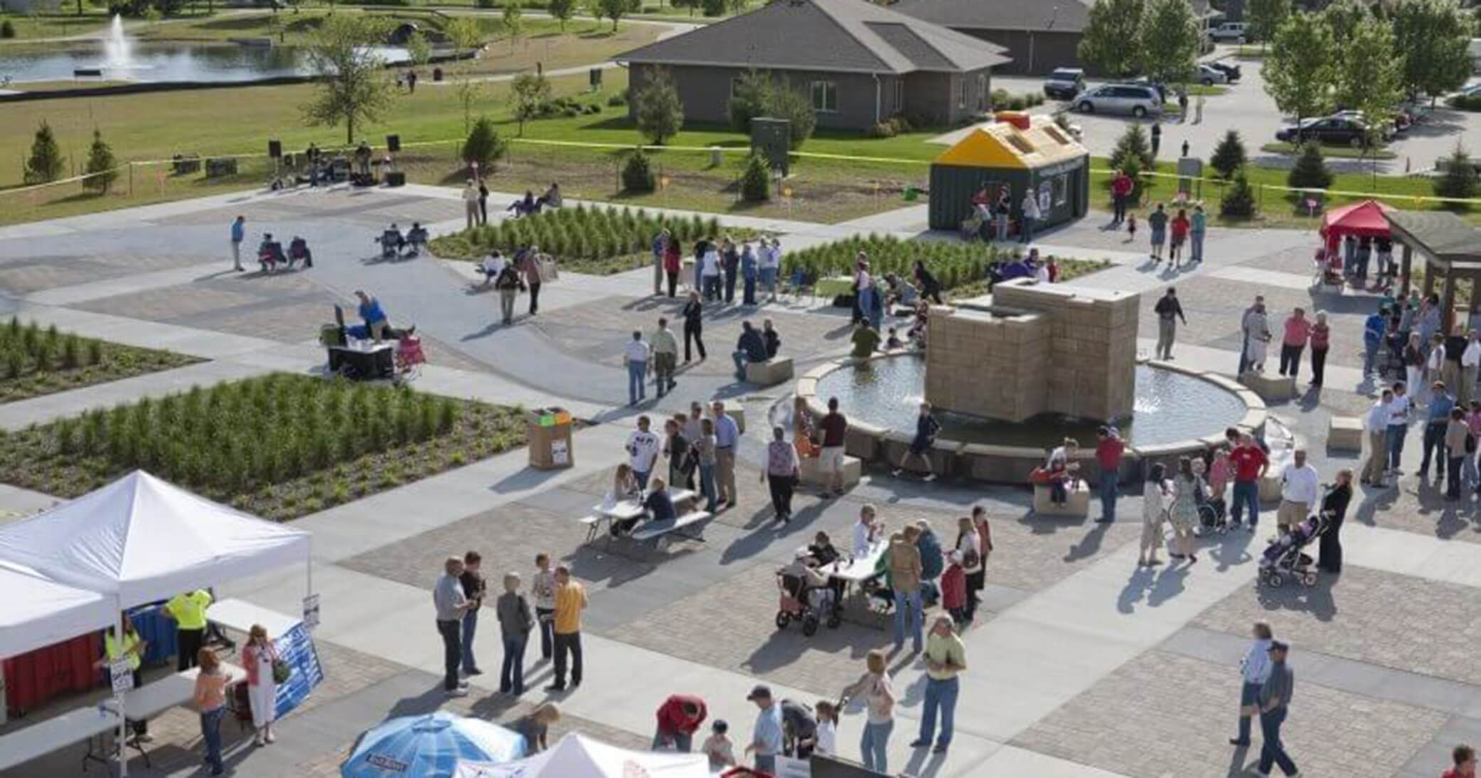
A rendering of the entrance to the Urbandale, IA Miracle League Field details what the public can expect visually once construction is complete.
Two other advantages that should not be overlooked are the use of 3D modeling to gain public input and support for municipal engineering projects. The other is the ability to avoid utility conflicts that could potentially have negative impacts on a project’s schedule.
A lack of public buy-in and utility conflicts are two of the most common project challenges our municipal clients face, shares Gabe Nelson, PE, Civil Engineer with Snyder & Associates. But as the advanced capabilities of survey technology and 3D modeling software become more widely known and utilized, I think those challenges will become less prevalent.
Through work with the Federal Highway Administration (FHWA) and the Iowa Department of Transportation (DOT), Nelson guides the use of 3D-engineered modeling software and helps promote the use of advanced survey technology. He also helps communities identify utility conflicts early on and credits the use of 3D modeling software for public engagement and project support initiatives.
It’s a big deal for our clients, says Nelson reflecting on recent project experiences. The use of new survey technology and 3D modeling boosts project efficiency, enhances the design, and provides better construction deliverables.
To increase usage and understanding of 3D-engineered models in highway construction, Snyder & Associates partnered with the Iowa Department of Transportation on the creation of the 3D Engineered Models for Highway Construction: The Iowa Experience manual. The manual describes how Iowa uses 3D-engineered models, from planning and surveying through design and construction.
Visualization models (left) take two-dimensional information from the design model (right) and give it three-dimensional verticality.
In addition, we also partnered with the Institute for Transportation at Iowa State University and the Federal Highway Administration to develop a 3D Engineered Models for Highway Construction Web-based training program. The highly engaging training program includes four 120-minute modules. View more details about the training program and registration information.
3D Modeling Enables Automated Machine Guidance (AMG)
The combination of 3D modeling and GPS allows construction crews to use Automated Machine Guidance (AMG) to complete projects faster and with improved quality and safety. GPS-enabled construction equipment can run virtually non-stop with guidance from 3D model data and achieve precise grades on the first pass. This level of accuracy reduces waste and the misuse of resources by eliminating human error and the need for change order rework due to faulty designs.
Using AMG also allows many manual tasks to be completed automatically and with machine-like precision. As a bonus, AMG decreases the need for certain tasks like staking, placing string lines, and setting grade stakes. This also leads to a reduced number of workers onsite which increases project safety. As the acceptance and use of 3D technology continue to grow, the technology has proven to be a cost-effective method for accelerating roadway and highway construction.
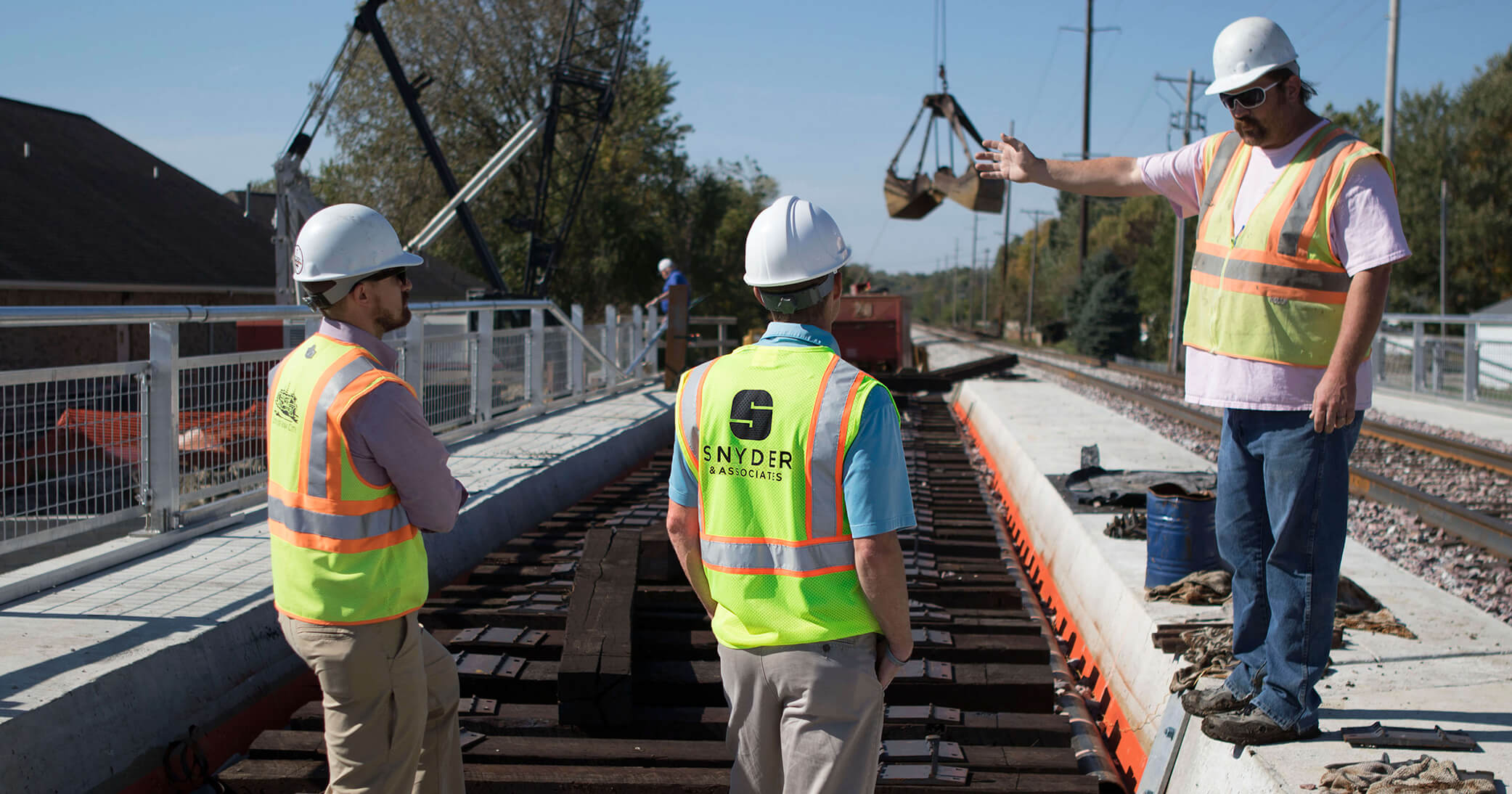
Quality Control Enhancements Through 3D Engineered Plans
In addition to increased schedule efficiency and cost savings, another benefit of 3D-engineered modeling during the construction phase is the ability for inspectors to use GPS rovers to spot-check elevations and horizontal offsets. With traditional 2D methods of construction, inspectors had to rely upon grade stakes and 2D paper plan sheets to ensure that grading operations were being constructed as the design intended. With the proposed grading surface within the 3D engineered model, inspectors can take random spot checks with GPS rovers to make sure the site is being graded properly.
The GPS rovers can compare the graded elevations to the proposed design surface at all locations within the 3D engineered model’s limits. Similarly, an inspector equipped with a robotic total station can spot-check elevations behind slip form paving machines to ensure the paving equipment is set up and working properly. Any problems discovered can be quickly resolved, reducing the amount of rework needed. By having the ability to spot-check elevations quickly and easily, inspectors can improve the QA/QC process during construction.
Post Construction the 3D Model Becomes the Record Drawing
Construction completion is not the end of the usefulness of the 3D-engineered model. With traditional 2D methods, record drawings were developed based on memory and any hand-written documentation provided by the contractor, construction observer, and engineer. If the record drawings are not updated throughout construction, there is a risk of forgetting important information that should be included. Traditional methods of developing record drawings also included obtaining as-built survey information — often requiring the owner to incur additional costs to perform this survey.
The 3D engineered model can be updated with as-built location data throughout the construction process. Special information and field modifications can be quickly and easily updated in the model. After construction is complete, the 3D model becomes the record drawing.
Thorough record drawings are also an important aspect when maintenance needs develop long after construction is complete. Since all construction projects have a useful life, the 3D model (record drawing) will have useful benefits as a base map for future maintenance or reconstruction projects, as accurate data in a GIS database, or to update asset management systems.
From the engineer’s perspective, accurate 3D modeling sometimes takes more time to complete than a traditional 2D design. However, this trade-off in time is easily surpassed by the long-term advantages. As the benefits are more widely recognized, many in the U.S. highway industry will continue to transition to 3D modeling over the traditional 2D design process.