
GIS & Asset Management
Reaching Informed Decisions through GIS
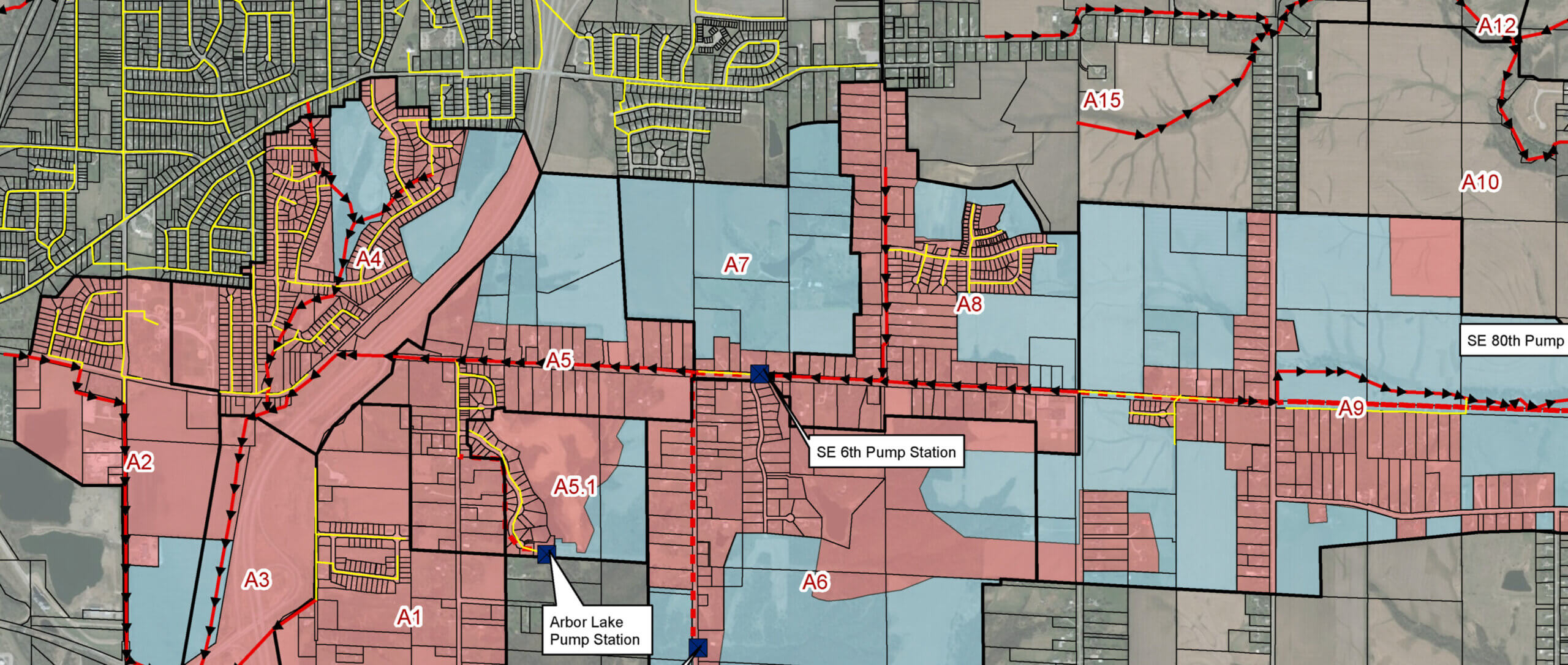
Using a Geographic Information System (GIS), we’re able to better understand spatial distributions of land, people, and resources. Data collected through GIS helps facilitate important discussions regarding community spaces and the challenges surrounding them. This allows us to gain valuable insight on how to develop and implement the best, long-term solution possible.
Improved Record Keeping & Indexing
For federal, state, and municipal governments and agencies, creating and maintaining adequate records can often involve many tasks spread out across many departments. In addition, data is often saved in various forms and locations.
GIS consolidates records and data, providing a uniform framework to manage and present different forms of data. Utilizing its database capabilities, data is recorded and analyzed. With a consistent framework, trends, patterns, and existing features are analyzed with greater accuracy.
Data Presentation
The ease of data manipulation and integration provides real-time information for community members, presentations, grant proposals, web pages, and other marketing efforts.
GIS Development Process
Working with you, we will create a custom GIS that enables data-driven decisions. Our development process includes:
- Needs assessment
- Identification of data gaps
- Data collection
- Data process & schema creation
- Data analysis
- Review of computer software & hardware requirements
- Identification of program development challenges
Snyder & Associates GIS & Asset Management Services
High-Accuracy Field Data Collection
Our team employs the latest in field survey technology to provide high-accuracy data, backed by a robust attribute system. This method provides our clients with meaningful, precise data and analysis on every project.
Database Creation & Management
We provide geodatabase creation, management, and storage for all working project data. It is structured and optimized to hold geometric data including shapefiles, feature datasets, and feature classes (e.g. points, symbols, and polygons that represent similar geographic objects).
GIS Mapping & Analysis
To effectively communicate project information, we can develop creative and informative maps and graphics. This allows spatial data to be analyzed using numerous GIS toolsets and professional expertise to create optimum solutions and designs.
Web Services Hosting
To allow access to data from any web-enabled device, our GIS specialists provide streamlined data viewing portals and applications. Data is hosted in secure cloud storage to ensure constant access to applications and data for individuals with permission to view such information.
Asset Management & Performance Measures
The query and analysis tools of GIS programs allow us to identify all features or areas that fit certain criteria or performance measures. We are then able to identify the strengths and weaknesses of public systems to develop plans and solutions for the future.


Contact Wade Greiman, P.E.
Transportation Business Unit Leader