Closes Creek Watershed’s History of Flooding
When a 2018 summer storm dumped nearly nine inches of rain in less than four hours in the Des Moines metro area, more than 1,000 homes experienced some level of flooding. In the aftermath, the city’s aging and deficient stormwater infrastructure were once again in the spotlight, particularly in the city’s historic Beaverdale neighborhood. In an effort to mitigate future flooding issues, the City of Des Moines implemented four long-term stormwater improvement plans for areas with previously inadequate drainage — one of those being the Closes Creek Watershed.
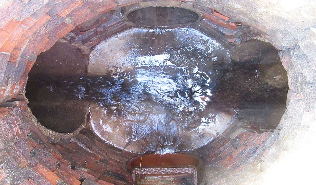
Repeated flooding events across this watershed have steadily increased throughout the years, with recurrent property damage upsetting homeowners. This issue can mainly be attributed to the undersized and aging stormwater conveyance system which features outdated technologies such as brick, limestone, and timber culverts. Snyder & Associates was initially brought on board to provide survey and modeling services for the initial portion of the project and was eventually awarded the overall project design that encompassed determining the best course of action to repair and replace the antiquated infrastructure.
Real-Life Modeling Leads to Right-Sized Solutions
Gaining a full understanding of the current stormwater systems in place was the first step in making improvements. To get a comprehensive view, our team utilized multiple study techniques, including field surveys, aerial topography, and structural investigations. This data was then used to develop a plan outlining design alternatives to alleviate frequent flooding throughout the entire watershed.
Once topographic and survey data were collected, our team analyzed the watershed’s hydrologic and hydraulic characteristics through modeling. To produce realistic flood elevations within streets and between homes, local stormwater facilities such as storm sewers, reservoirs, culverts, as well as overland and bypass flow routes were included in the model. This simulation proved invaluable when calibrating to known flood events and preparing detailed cost-effective plans and priority measures.

Real-life modeling shows how added detention basins would fair after varying amounts of rainfall.
Flood Mitigation Efforts across Entire Watershed
The proposed improvements advised by our team were divided into manageable projects based on current budget information provided by the city. A detailed construction sequence was then created based on the estimated level of risk from previous flood event damage. This method established construction sequencing criteria to upgrade the areas experiencing the most extreme flood levels and damages first.
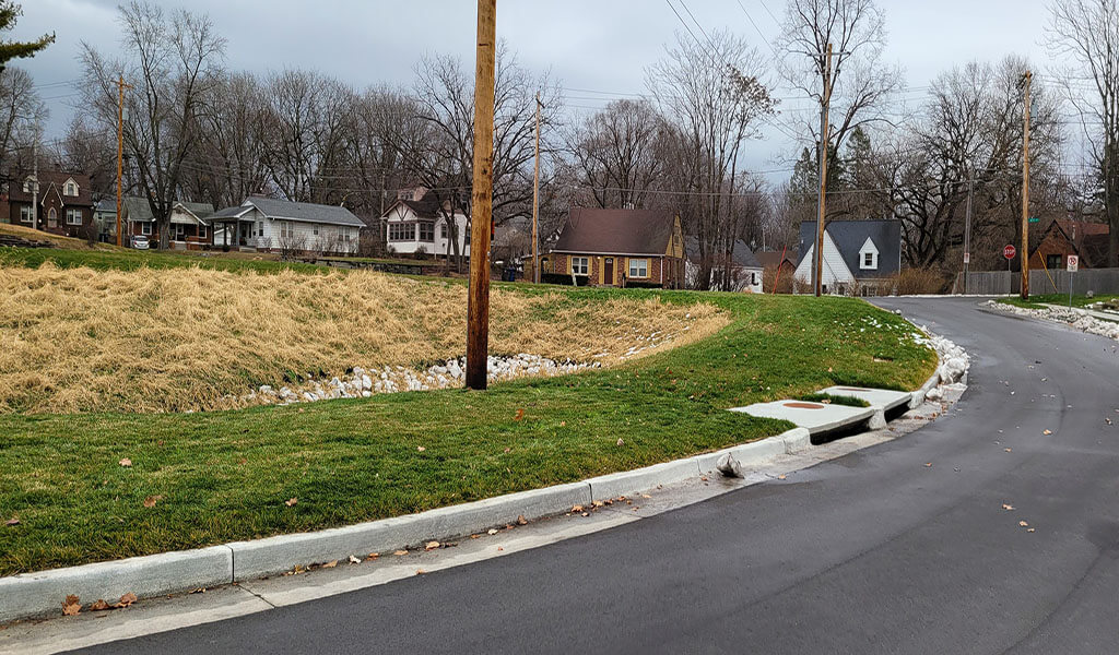
To date, phases 1A and 1B, which consisted of a storm sewer box replacement, storm sewer updates, and an underground detention basin at the corner near 47th Street and Holcomb Avenue, have been completed. Up next, phases 2A and 2B will take place simultaneously throughout 2021. Phase 2A is designed to improve the capacity of the stormwater culverts stretching from Beaver Avenue to 34th Street. Phase 2B proposes installing a multi-level detention basin to help mitigate downstream peak flows along with additional storm sewer infrastructure to increase the capacity of the existing system near Perkins Elementary School on College Avenue.
Phase 3, which increases the capacity of the storm sewer system above the Phase 2B basin, is currently under design and anticipated for construction in 2022. Additional phased improvements have been recommended and will follow in subsequent years as funding allows.
This project’s primary goal and benefit are to reduce overall flood occurrences by providing regional storage and detention of rainfall for the entire watershed and the addition of adequately sized storm sewer infrastructure. Each phase’s current design works collectively to produce sufficient detention for a 25-year storm occurrence and helps better manage and convey stormwater flows to mitigate the impacts of major storms in the future.
Public Inclusion in Project Decision Making
Community involvement throughout the entire process was crucial in developing accurate model calibrations and watershed improvements. Input was gathered through questionnaires sent to households in the flood-prone areas, general public meetings, and local resource groups.
These opportunities allowed residents to voice their concerns about their neighborhood and give a sense of direct involvement with the recommended improvements. Hundreds of local voices contributed to the process via these outreach efforts. The groundwork laid during the public involvement process, coupled with the detailed, prioritized construction sequencing, has allowed for a seamless transition into the construction of the recommended stormwater improvements.