|field-drainageway")
404 Permitting is Critical for our Waterways’ Health
To protect human health and the environment, the Environmental Protection Agency (EPA) strictly regulates waterways in the United States. Whether you’re a private landowner, a for-profit developer, or a public or private agency or organization, the Clean Water Act (CWA) is the primary law governing water pollution. The CWA also requires specific permits to be obtained before construction or development occurs near U.S. waters. The rules for one of these permits can be found in Section 404 of the CWA. Specifically, Section 404 seeks to avoid or minimize losses to wetlands and other waters of the United States (WOTUS) by regulating the discharge of dredged or fill material. This includes altering or filling a jurisdictional water body for any of the following reasons:
- Commercial or residential development
- Water resource projects (i.e., levees and dams)
- Waterway enhancements (e.g., county or state parks)
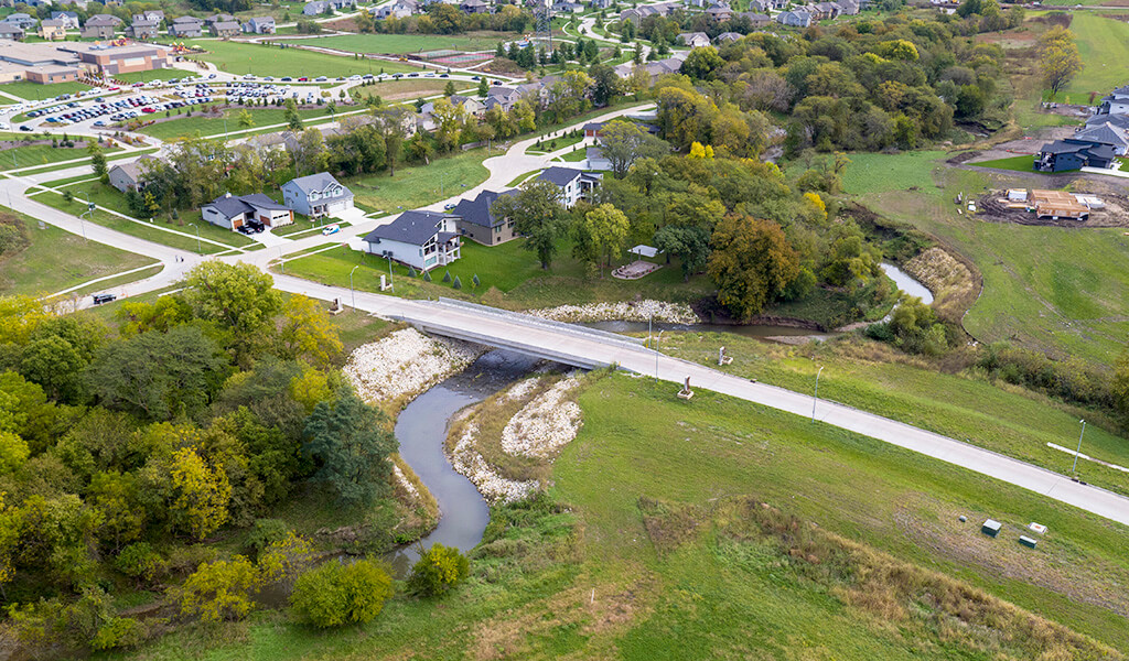
- Infrastructure projects (i.e., roads, bridges, trails, and airports)
- Mining and resource extraction operations
- Various other operations
One goal of the 404 permitting program is to encourage landowners and developers to consider practical alternatives that may be less damaging to the WOTUS and that any action taken will not significantly degrade a protected body of water. The mere act of applying for a permit means that you can show that steps have been taken to avoid impacts to nearby waters and, where unavoidable, the potential impacts have been minimized. For those projects that simply can’t avoid impacting a WOTUS, 404 permitting acts as the equalizer. The issuance of the permit assures that any adverse effects on a protected body of water are mitigated and that compensation will be provided for all remaining unavoidable impacts. The idea behind 404 permitting isn’t to prevent progress or make it difficult to complete projects — it’s to ensure the quality of the nation’s waterways for future generations.
Experienced Professionals to Handle Complex Rules
Complex waterway projects benefit from the services of a full-service, multi-disciplinary organization.
Navigating the complexities of the 404 permitting process requires the services of a knowledgeable and trusted partner. The professional staff at Snyder & Associates has almost two decades of experience performing this service for our clients. Led by Principal Environmental Scientist Jeff Walters, our team is fluent in handling all permit types (more on this later), and we’ll work with the regulatory body to ensure your permit is completed as efficiently as possible. As part of a multi-disciplinary organization, our environmental scientists can handle any stand-alone WOTUS project that requires 404 permitting.
Additionally, our team is backed by an entire staff of civil and structural engineers to coordinate on larger projects that may have a water component, such as a bridge or dam. And because the Clean Water Act is a fluid document that is periodically revised due to new legislation, you’ll benefit from engaging an experienced team that works tirelessly on your behalf using the most current information.
New Navigable Waters Protection Rule (NWPR)
The introduction of the Navigable Waters Protection Rule (NWPR), finalized in January 2020, is a recent example of changes that can occur to the Clean Water Act. The NWPR establishes a new definition for waters of the United States that revises the 2015 definition. In short, the NWPR creates four categories of jurisdictional waters federally regulated under the CWA and twelve categories of excluded waters and water features. The four categories of jurisdictional WOTUS defined by the NWPR are:
- Territorial seas and Traditional Navigable Waters (TNW)
- Tributaries
- Certain lakes, ponds, and impoundments
- Wetlands adjacent to jurisdictional waters
Within these four categories of jurisdictional WOTUS, fundamental changes that we’ve identified as having the most significant impact on our clients include:
- Removal of jurisdictional status for ephemeral streams
- Lakes, ponds, and impoundments are jurisdictional ONLY if they have connectivity to TNW and tributaries
- Wetlands adjacent to TNW, tributaries, ponds, lakes, and impoundments are jurisdictional, even if they have a physical separation
- Ditches may have jurisdiction under certain circumstances
The list of waters excluded from jurisdiction as defined by the NWPR is as follows:
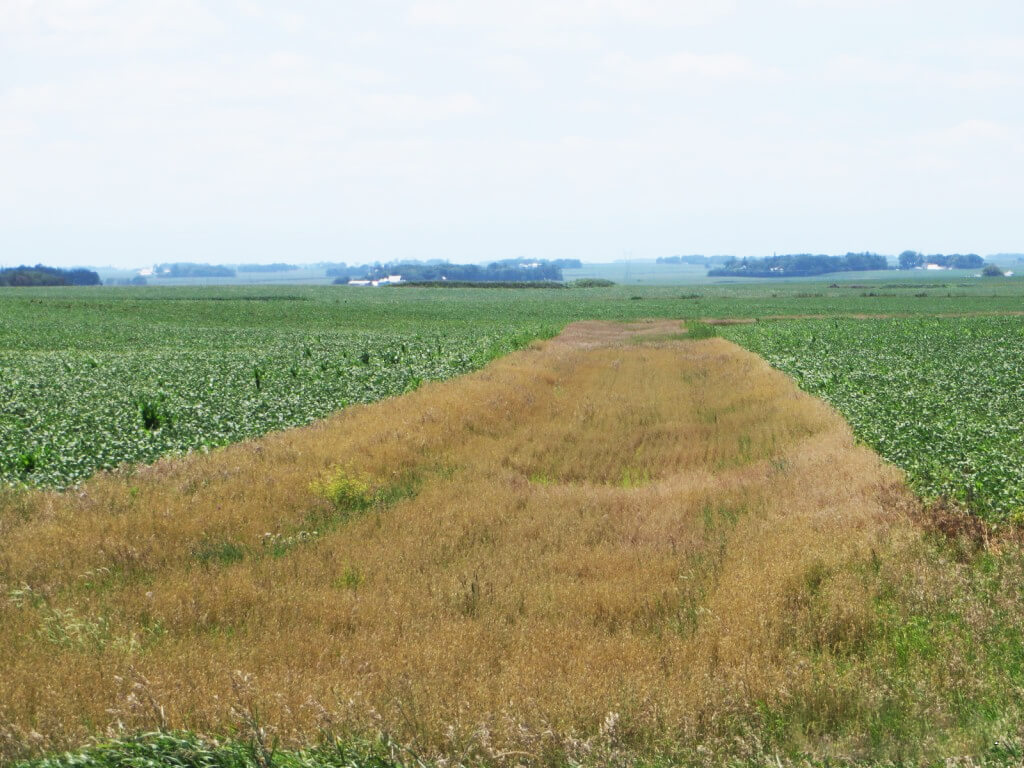
View of a typical, non-jurisdictional ephemeral drainageway located in a farm field.
- Waterbodies not included in the four categories listed above
- Groundwater
- Ephemeral features
- Diffuse stormwater run-off
- Ditches not identified as WOTUS
- Prior Converted Cropland (PCC)
- Artificially irrigated areas that would revert to upland if irrigation ceased
- Artificial lakes and ponds
- Water-filled depressions incidental to mining or construction activity
- Stormwater control features
- Groundwater recharge, water reuse, and wastewater recycling structures
- Waste treatment systems
Despite these changes, the workflow process for identifying WOTUS, including wetlands, still includes the completion of a wetland and stream delineation-first. Also, HEC-RAS modeling can be used with a field delineation to perform inundation mapping and create inundation depth datasets. The use of HEC-RAS modeling benefits our clients by verifying the jurisdiction of a wetland or stream. This, in turn, should reduce the USACE review process when determining jurisdiction on complex projects.
The changes brought about by the NWPR have a more significant impact once wetland and stream delineations are completed and the permitting phase of a project begins. The U.S. Army Corps of Engineers (USACE) is responsible for issuing Section 404 permits and monitoring their compliance. As USACE district offices begin phasing in these new rules, our team will continue questioning and challenging district decisions to serve our clients best. Our thorough understanding of the new NWPR definitions ensures we can better advocate for our clients and help streamline the permitting process.
Working with the USACE

Environmental scientist in the field performing a wetland delineation.
Permitting a project with the USACE shouldn’t cause project delays and cost overruns. When handled by experts in the field, it’s similar to securing a building permit from a city or county office. Having performed nearly 500 wetland delineations over the past 20 years, our team ensures that every project is permitted appropriately, on time, and without any added expense. We’re well-versed in the nuances of Section 404 and have forged relationships with the critical decision-makers in most district USACE offices — one of the many vital, unseen benefits we bring.
Three critical elements to obtaining a USACE permit successfully are understanding impacts, the appropriate level of documentation, and time. Section 404 permits fall into one of three categories: Nationwide (NWP), Regional (RP), and Individual Permits (IP). The USACE typically only issues two of these types: NWPs and IPs. The main difference between an NWP and an IP is a project’s scale of impact on aquatic resources, including rivers, streams, and wetlands.
The USACE will issue an NWP when impacts to wetlands are less than one-half acre and separated from the nearest river or stream by less than 300 or 500 linear feet, respectively. When impacts exceed these thresholds, the USACE will issue an IP. An IP requires additional documentation, including threatened and endangered species reviews, alternatives, analysis, and cultural resources investigations. It should also be noted that all projects exceeding one-tenth acre of wetland impacts and/or 300 linear feet of stream impacts require mitigation.
Most Nationwide and all Individual Permits require a wetland and stream delineation to identify wetland and stream boundaries within the project site. The delineation report includes the project location, purpose and need of the proposed action, and a summary of findings. Impacts are determined by transferring the delineated wetland and stream boundaries into the project design plans.
Snyder & Associates uses the wetland delineation reports and design plans to fill out the USACE permit application form directly. Turnaround time for receiving an NWP is typically 6-8 weeks, while an IP is generally accepted in about 180 days.
Early Professional Involvement Beneficial for Obtaining 404 Permitting
We recommend engaging our environmental sciences staff early in the project scope whenever possible. This allows us to best serve you by determining the documentation and time required to obtain a USACE permit and to ensure the permitting process is completed as efficiently as possible. However, we fully recognize that a lack of understanding of permitting requirements or existing property conditions can delay seeking outside support. And that’s not uncommon. So even if our professionals aren’t consulted until late in the game, we’re still equipped to complete the job successfully.