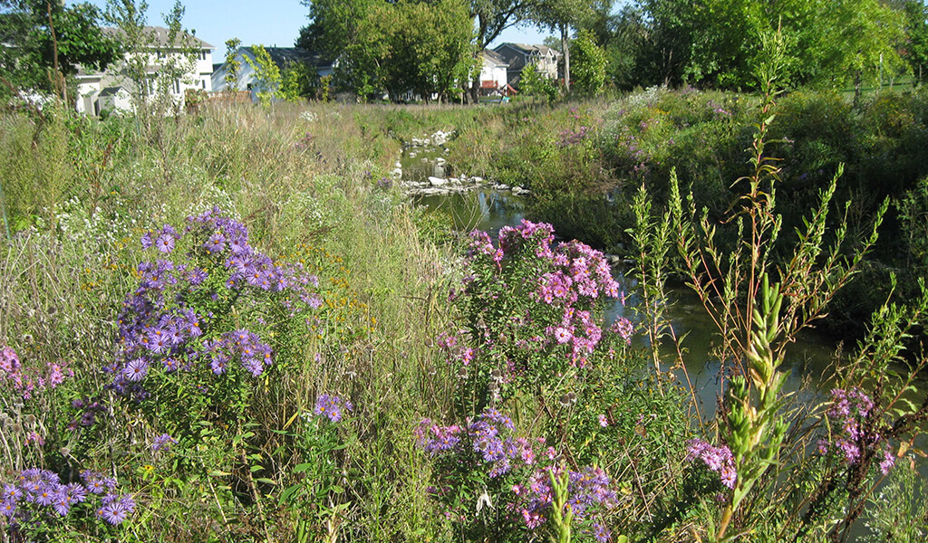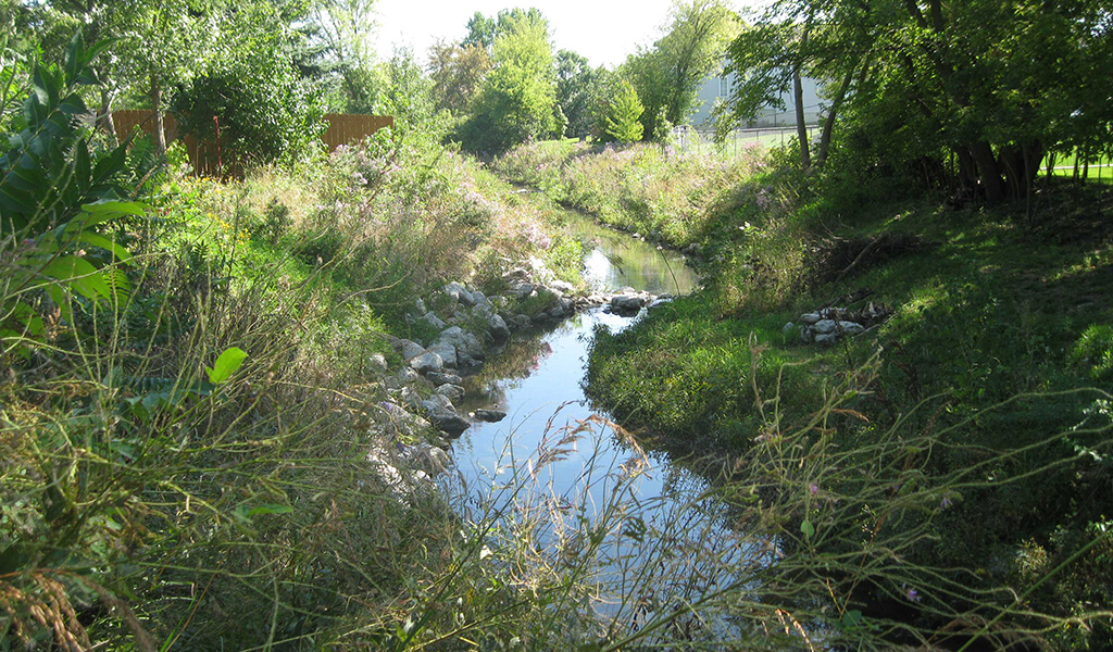
The banks of Fourmile Creek are undergoing stabilization efforts utilizing rip-rap and vegetation.
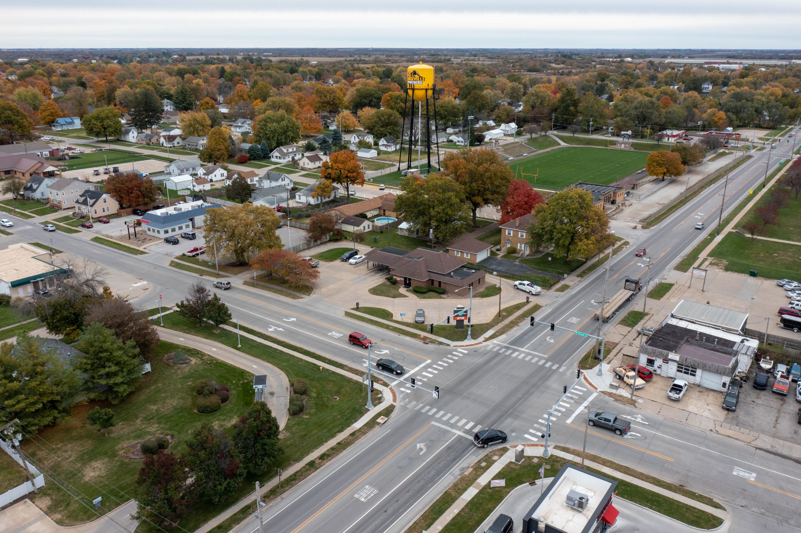
The Fourmile Creek Watershed in central Iowa consists of nearly 80,000 acres of urban and agricultural communities. It’s also home to over 80,000 residents. As this population has grown over many decades, this expansive watershed has become increasingly prone to regular flood events.
These reoccurring floods have impacted numerous residents, resulting in frequent evacuations and the costly destruction of property. Extensive efforts have been taken by several government agencies to minimize flooding and enhance the overall water quality in the watershed. A seasoned team of engineers and environmental scientists from Snyder & Associates has been at the forefront of these efforts since 2006. Through a multitude of projects, our team has made a significant difference in the health and safety of this critical water system.
Updating Fourmile Creek Modeling & Assessments
Initially, Snyder & Associates was commissioned to study the Fourmile Creek Watershed to establish an accurate floodplain model to update the significantly outdated Federal Emergency Management Agency (FEMA) maps. Our team of environmental scientists and engineers used hydrologic and hydraulic flood models, along with stream assessments, to evaluate the impact of flooding on future development and the impact that development may have on the watershed.
Hydrologic methods from previous studies only accounted for current land use while grouping the entire watershed into one basin. Our team completed a comprehensive review of both existing and future land use plans to predict potential conditions in hydrologic models. Each of these models divided the 118-square mile watershed into individual sectors to provide a more accurate analysis.
Peak flow rates developed through modeling were used to predict Fourmile Creek’s response to flood events of varying magnitude and duration. A profile of the watershed patterns was established to create flood maps utilizing LiDAR data and ArcGIS software. These maps provide valuable information by increasing awareness of the likelihood of flooding and ultimately, reducing the devastating impacts floods can produce.
Streambank Stabilization Increases Watershed Resilience
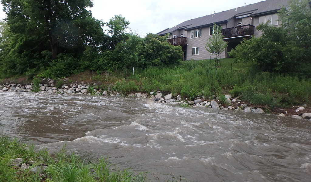
Stream flooding in Fourmile Creek Tributary A prior to stream stabilization improvements.
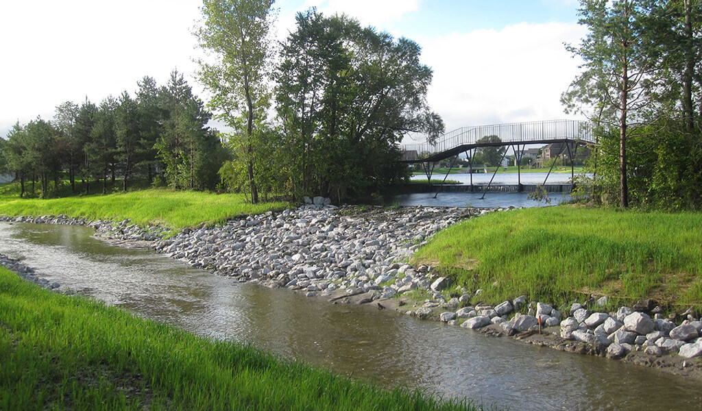
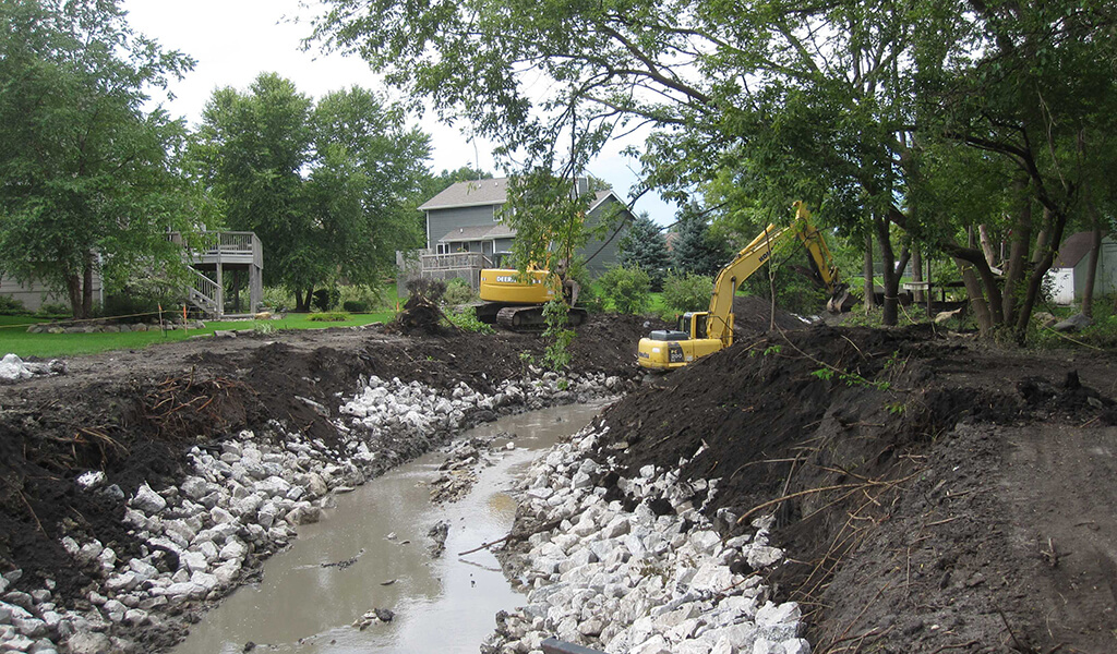
In addition to extreme flooding issues, Fourmile Creek has a long history of erosion and poor water quality. Many factors, such as above-normal precipitation and runoff volumes, impervious surfaces, and agricultural practices within the watershed contribute to the stream’s degradation and erosion. Specifically, two tributaries of the creek located in Ankeny — Northeast Tributary A and Southeast Tributary B — experienced extensive stream degradation and bank erosion after the 2008 floods and placed many properties and infrastructure at risk.
To address these individual tributaries, our team assessed over 7,400-feet of the stream before proposing improvements that would not only mitigate flooding but also complement the stream’s natural protection, as well. This assessment, along with our intimate knowledge of the watershed, led to sustainable design solutions.
Homeowner input, technical assessments, and an evaluation of alternatives were utilized to prepare conceptual designs for both tributaries using an integrated stream restoration approach. This approach provided cost-effective and aesthetic creek restoration through the combination of several techniques including vegetated buffers, toe protection, graded floodplain benches, and weirs. Combined, approximately 6,500-linear-feet of the stream was successfully stabilized at the conclusion of both projects.
Fourmile Creek Watershed Management Authority & Stormwater Management Plan
While the rehabilitation of the two tributaries drastically improved the creek’s overall water quality, additional efforts were necessary to continue mitigating flooding, erosion, nutrient loading, and bacteria issues. To address these problems, local communities created the Fourmile Creek Watershed Management Authority (FCWMA) in 2012. This group focuses on collaborative work to address both flooding issues and water quality. Snyder & Associates was commissioned to study the region with the intent of improving the understanding of the watershed and preparing a stormwater management plan.
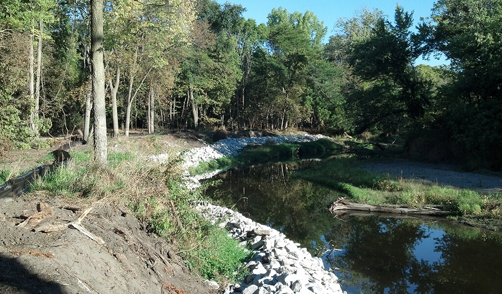
Our experts knew that appropriate mitigation had to account for a powerful, meandering alluvial stream that transports significant sediment load. In some cases, extreme events caused substantial channel changes due to high flow, debris jams, erosion, and sediment deposition. Toe rock protection integrated with bendway weirs, floodplain benches, and native vegetation buffers were incorporated into the design. Additional measures included establishing permanent easements and expanding Polk County’s adjacent conservation area which helped diversify stream habitat and increased wildlife access to the water.
This management plan also addresses overall maintenance goals and responsibilities, budgetary costs, and phasing for the full development of the comprehensive system. Additionally, potential regulatory tools, grants, and funding opportunities were outlined and adopted by all jurisdictions involved.
Fourmile Creek Greenway Master Plan
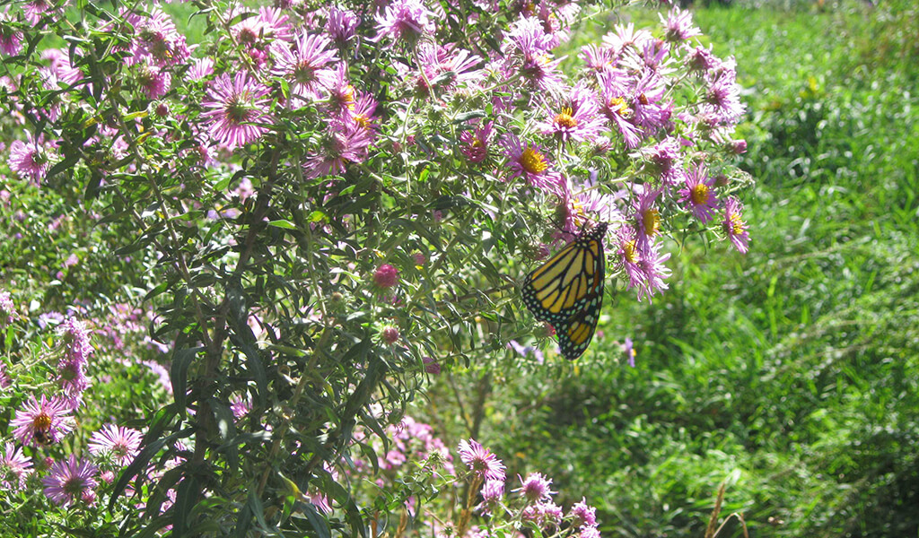
A series of eight watershed goals aimed at reducing flooding and improving water quality were included in the plan to provide guidance. Each goal was assigned subgoals and tasks to help track milestones and develop a schedule. The adoption of a greenway system, or master plan, was one of the eight primary goals of the FCWMA. This specific goal outlines practices, such as native vegetation re-establishment, stream restoration, and wetland enhancements. The Greenway Master Plan addresses these improvements, as well as potential recreation and education opportunities along approximately 10-miles of the creek.
Stakeholder input and thoughtful consideration of multiple elements are essential when planning and implementing a greenway system. During a public open house, our team gathered community input for the future of Fourmile Creek, which helped shape the plan’s objectives.
Greenway Master Plan Objectives:
- Flood management and water quality
- Native habitat protection and management
- Define greenway
- Make connections
- Public access and service
- Education
- Economic development
- Implementable steps
The Greenway Master Plan provides a path to transform the current, developed landscape to a more natural state. To start, it’s necessary to move at-risk human life, property, and infrastructure away from the floodplain. In place of the developed landscape, work commenced establishing oxbow wetland connections, construction of a stormwater wetland, and prairie restoration. Once completed, this corridor will provide many community benefits including recreation, alternative transportation, improved water quality, habitat conservation, and flood control.
Stormwater Wetland Reduces Nutrient Overloads & Flooding
As the greenway plan expanded, partners of the watershed project saw an opportunity to be proactive in developing a solution to protect the environmentally sensitive Fourmile Creek. This resulted in a stormwater wetland which once again brought our team on board to provide environmental and stormwater design services.
Positioned adjacent to the popular Gay Lea Wilson Trail, the stormwater wetland provides a natural means to remove pollutants from stormwater and reduce overall flow rates. As stormwater is captured within the wetland, pollutants are removed naturally through reduced water velocity and increased settling, uptake, and filtering by vegetation.
Volume control is a particularly important benefit as there are downstream portions of Fourmile Creek that have been restored and stabilized, but there are other locations that continue to suffer from severe bank erosion. Managing the channel protection volume in the wetland improves overall stabilization efforts to reduce sediment transport.
The stormwater wetland helps to treat and slow down 23 acres of stormwater runoff from an adjacent suburban landscape before entering Fourmile Creek. Improvements like this help to reduce sediment and pollutant loading into the Des Moines River further downstream, protecting it for years to come.
Fourmile Creek Restoration Gives New Life to Natural Areas
For over 15 years, Snyder & Associates has helped shape implementation efforts across the Fourmile Creek Watershed through both agricultural and urban areas. Today, work on the Fourmile Creek Watershed continues with stabilization improvements and public education outreach that teach residents how to better take care of our watersheds. The Snyder & Associates team stands ready to continue providing guidance for this beneficial and forward-looking endeavor.