Iowa’s Best Recreational Trail, PCC Paving Project Award 2011, Iowa Concrete Paving Association
Trail System Links City & County Amenities
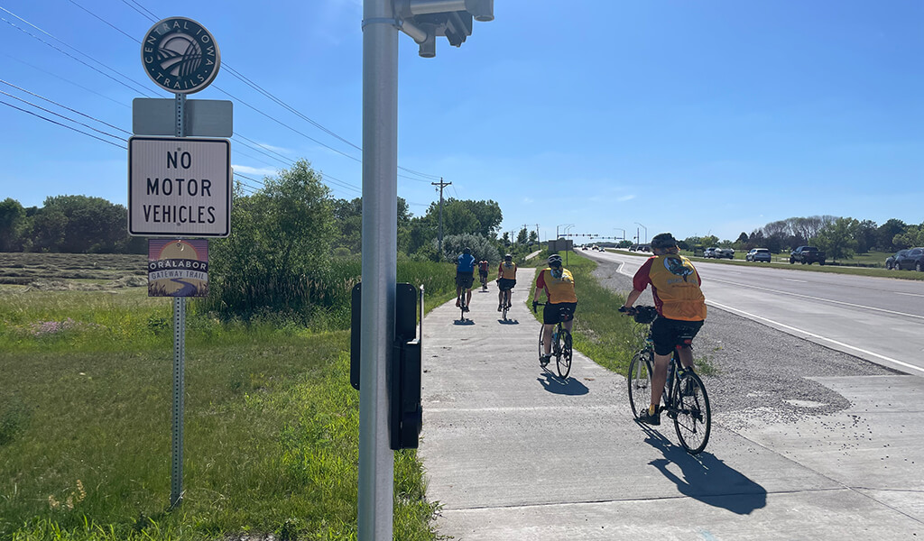
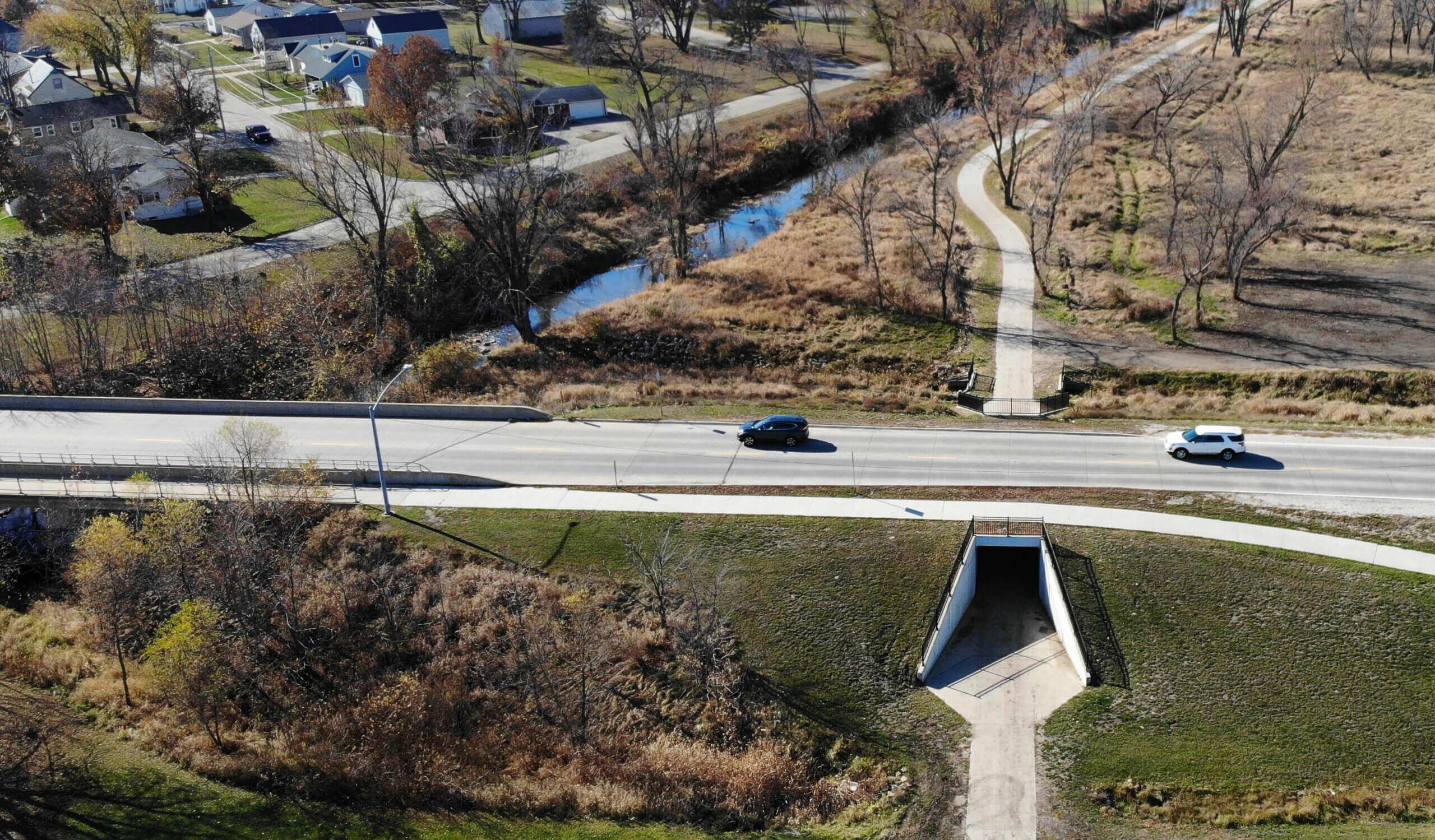
Most of the trail route has a substantial separation from high-speed vehicle traffic.
Increasingly, multi-modal trail systems are considered indispensable infrastructure for communities of all sizes. However, it’s also essential that trail systems be linked together to give trail users full access to the places they want to go. The Oralabor Gateway Trail provides one of those critical links, joining the Neal Smith Trail with the confluence of the Gay Lea Wilson Trail and the soon-to-be-completed, High Trestle Trail extension along Oralabor Road in Ankeny. The engineers and planners with Snyder & Associates played an instrumental role in the design and alignment of this consequential trail.
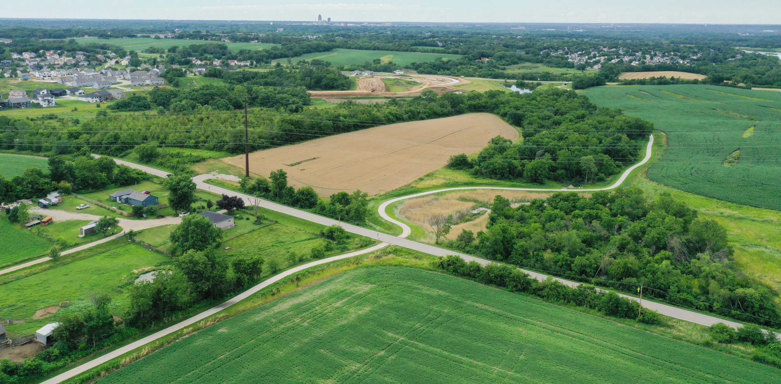
Rural & Urban Scenery Highlights Trail Route
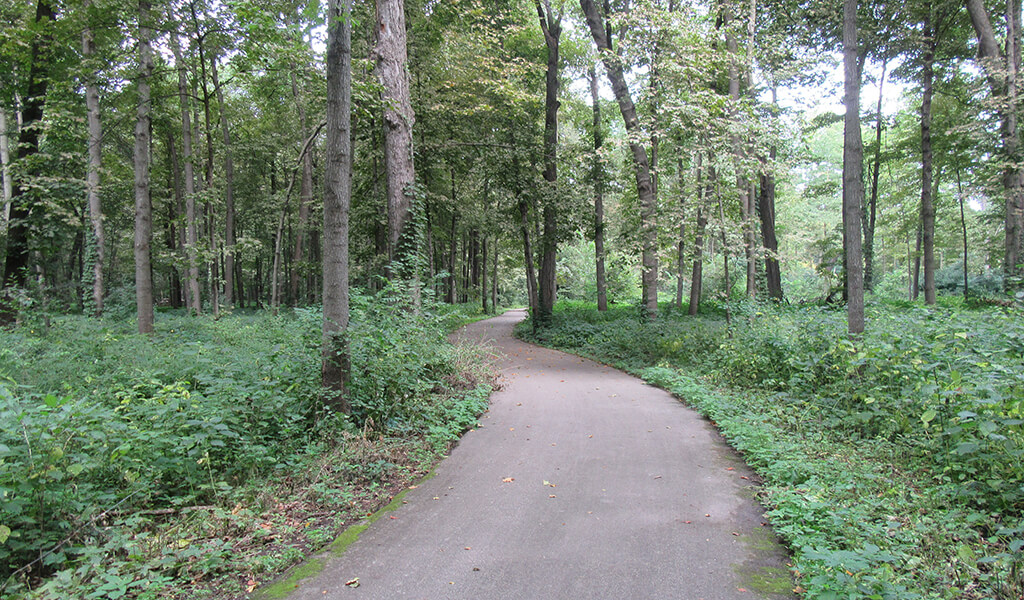
Initially dubbed the Neal Smith to Ankeny Trail, the Oralabor Gateway Trail originates at the Neal Smith Trail south of Saylorville Lake in Polk County. The near five-mile-long trail consists of a 10-foot-wide Portland cement concrete pathway that travels through rural and agricultural land, as well as city parks and residential neighborhoods. Completed over the course of two construction seasons, the trail created a vital link that connects a 600-mile trail transportation network in central Iowa.
Since a portion of the trail was built within the Des Moines River floodplain, the construction permit required that no fill be placed. This stipulation posed some challenging drainage issues for our design team. However, they were able to skillfully design the trail’s alignment and profile to meet this “no fill” requirement. In the process, our team was also cognizant to minimize the impacts on natural surroundings. All tree and plant removals were selective and carefully considered to minimize any environmental impact while also achieving proper design standards.
Wetland Mitigation Efforts & User Accessibility Top Priorities
Our team’s trail alignment also took into consideration the existing wetlands in the area. Although trail design minimized these impacts, some wetlands could not be avoided. Using the state’s wetland mitigation bank, the project included the construction of approximately 1/3 acre of new wetlands to mitigate for the impacted areas.

A durable restroom facility serves trail users at Glenbrooke Park.
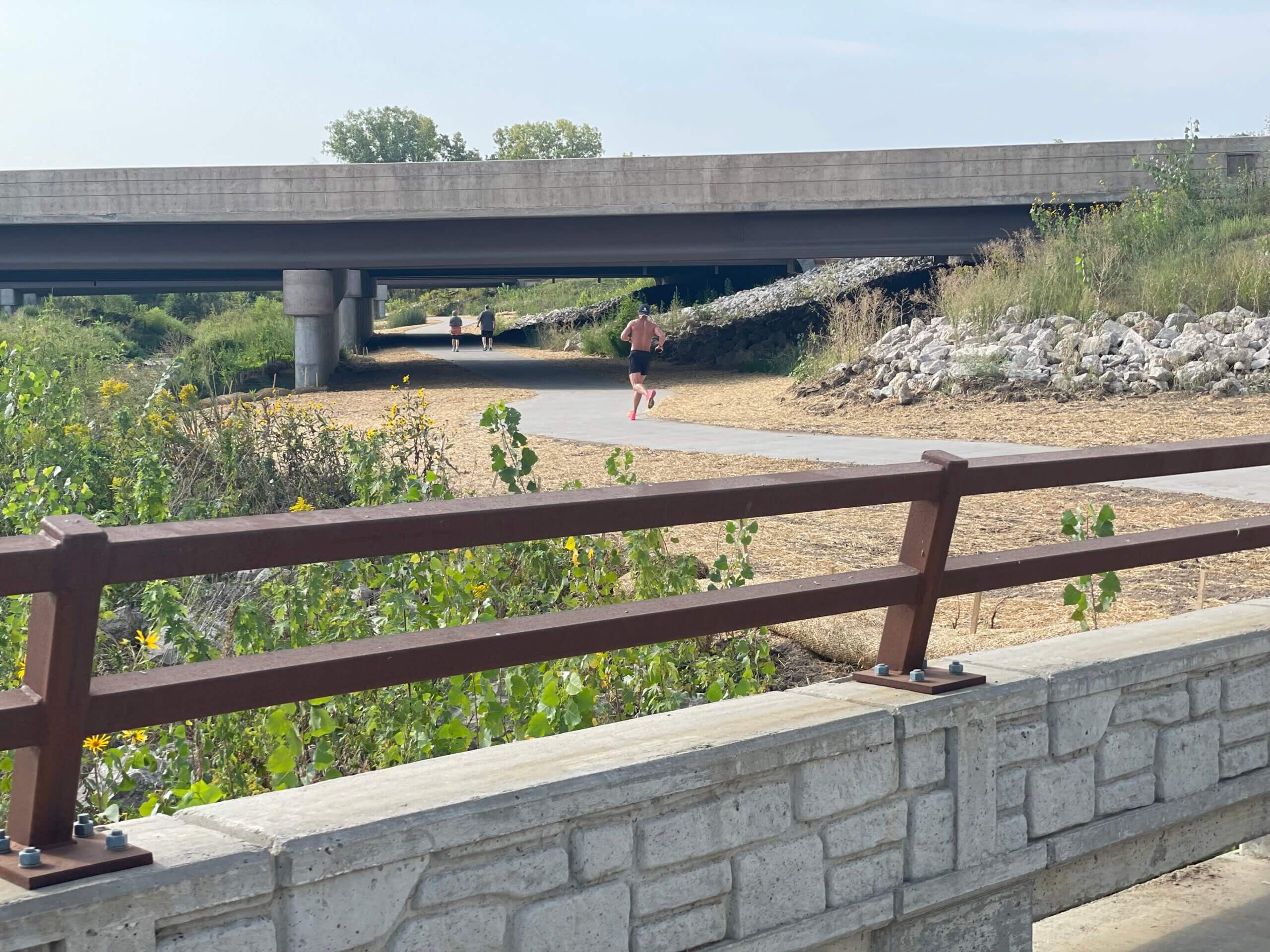
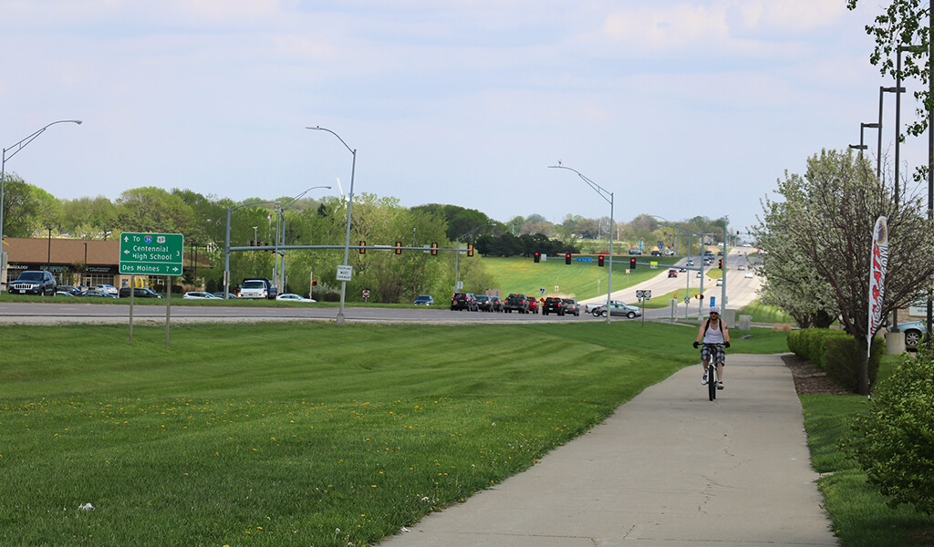
While most of the trail was constructed on level terrain, one section along Northwest 26th Street required steeper grades, up to five percent in some places. Our designers, however, were still able to account for user accessibility along this section while reducing large earthwork cuts and fills and accommodating the existing drainage patterns. Additionally, the gentle curvature of the horizontal alignment adds to the user experience along the trail.
The trail crosses Northwest 26th Street at the intersection with Highway 415. It was designed with future signalization in mind to maximize trail user safety. Since the trail’s completion, traffic signals have been installed at the intersection. Further to the east, the trail passes through Glenbrooke Park. Our team added a restroom facility into the design to serve the trail and park visitors.
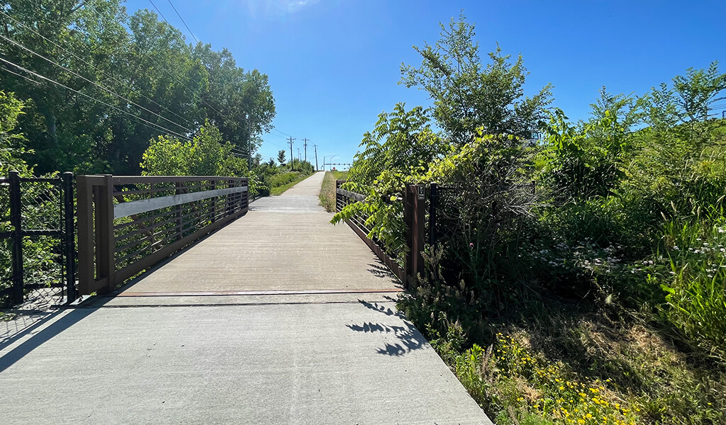
Right-of-Way Utilization & Pedestrian Bridge
The trail was constructed entirely within existing right-of-way and where permanent easements existed. Many of these boundaries were established in the late 1990s. These tight parameters presented a unique challenge to keep construction limits within this narrow space. Trail alignment was carefully considered by our designers to accomplish this.
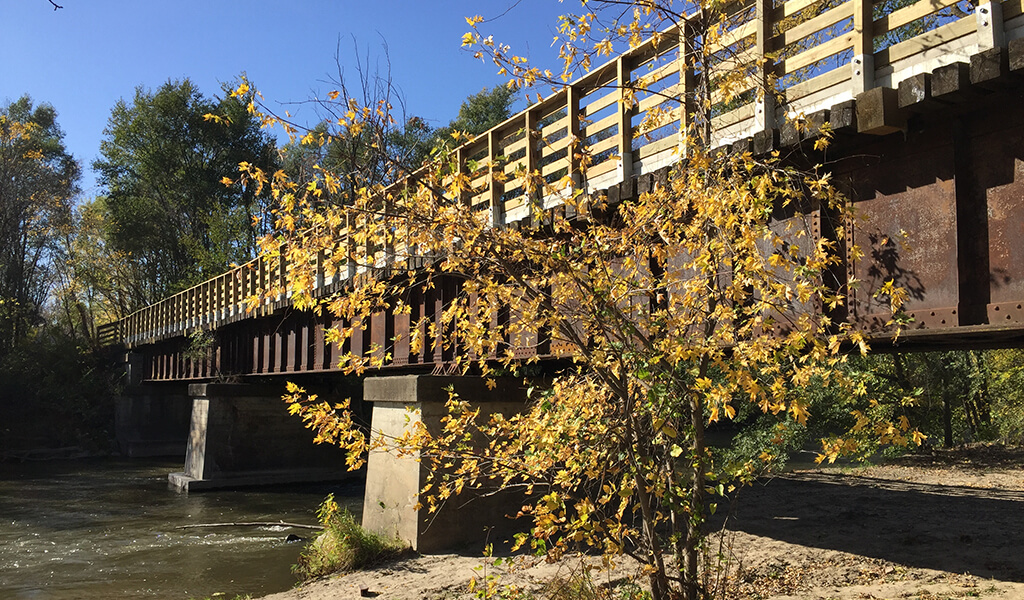
The trail network also passes by Des Moines Area Community College (DMACC) on the south side of Oralabor Road, passing over the DMACC Lake spillway outlet that runs under the roadway. Supported by cast-in-place retaining walls, our team designed an attractive and durable pedestrian bridge that adds a unique rest stop for trail users.
The complexity of the Oralabor Gateway Trail is easily overshadowed by the quality of the trail’s construction. While the steepness of the trail’s profile created paving challenges in several locations, the completed trail has resulted in a network link that provides full user access throughout the region.