2727 SW Snyder Blvd, Ankeny, IA 50023

1 (888) 964-2020


Navigation

Back to Projects | Project Categories: Trails

Rolling Prairie Trail Provides Rural Link Across Iowa’s Scenic Landscape

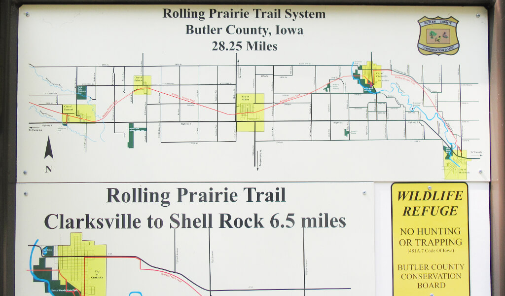
A Rolling Prairie Trail System map shows the trail’s gently winding path through five rural communities.

When rail transportation in Iowa peaked in the early 1900s, the state was home to more than 10,500 miles of track. As automobiles became the preferred mode of transportation, many short-line railroads that crisscrossed the state became less profitable and were ultimately acquired by larger companies or abandoned altogether. Today, fewer than 4,000 miles of track remain operational throughout the state. Advocates are working to convert many abandoned rail lines into multi-use trails, reinvigorating rural connections and providing recreation and tourism opportunities for residents and visitors.

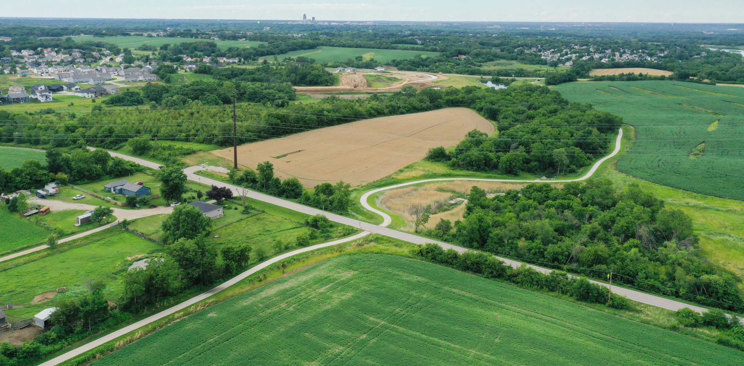
The Conservation Board in Butler County is diligently working to complete one such rails-to-trails project known as the Rolling Prairie Trail. When complete, the Rolling Prairie Trail will wind its way through five Butler County communities and connect to trails in Franklin County to the west and Bremer County to the east. After receiving an Iowa DOT State Recreational Trails (SRT) Program grant and acquiring the land for the trail’s path, the Butler County Conservation Board partnered with Snyder & Associates due to our firm’s extensive rail-trail development experience.

Aging Railroad Crossings Require Structural Retrofit

Our team identified a previously unknown drainage structure on the trail route during an initial site visit. This discovery helped avoid a potential drainage issue before the project was awarded. From there, our seasoned trail professionals were able to quickly begin the process of designing the 5.45-mile stretch of the trail connecting the city of Allison to neighboring Bristow. The Butler County Conservation Board had previously cleared and grubbed the trail path before the completion of the design. This enabled our team to begin their topographic survey and drainage analysis promptly, allowing planning and permitting to progress.

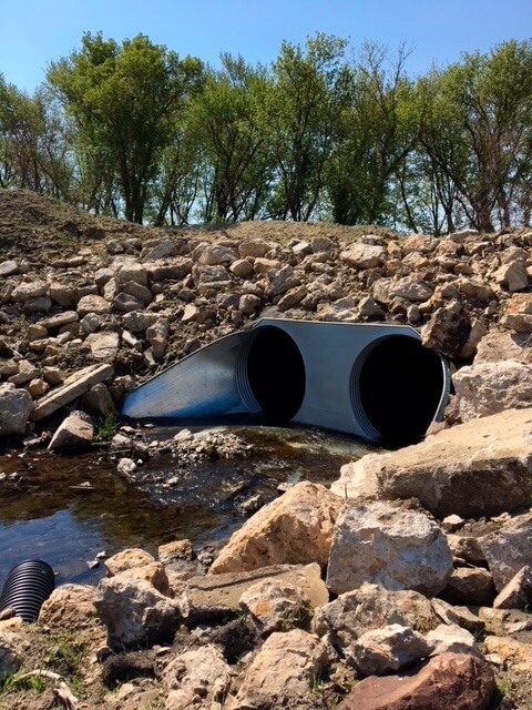
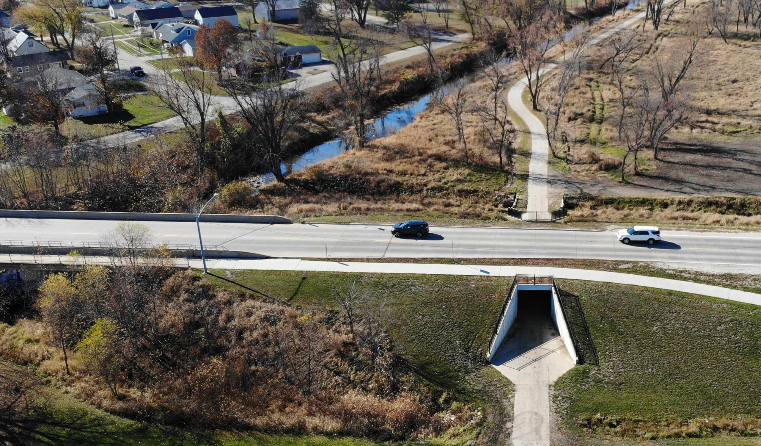
An in-ground drainage system manages stormwater and keeps the Rolling Prairie Trail safe and accessible.

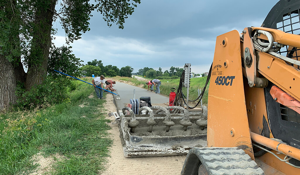
The trail alignment for the Allison to Bristow segment included five paved gravel road crossings and one crossing of local Highway 14. Additionally, multiple existing bridges and drainage structures required attention ranging from complete removal and replacement to reinforcement and retrofitting. Our design team worked with Butler County Conservation to develop a plan for addressing each structure. The Butler County Conservation Board updated and reinforced the existing bridge structures, and our team handled the planning and installation of in-ground stationary drainage systems. We also provided construction observation and administration services during the trail project’s excavation, grading, and paving portions.

To comply with the conditions of the SRT grant, our team followed the DOT’s Federal Aid Policy Guide and completed coordination with multiple agencies. They also ensured that each trail crossing was ADA-compliant and included signage designed to alert drivers, bikers, and pedestrians of approaching intersections. Removable bollards were added to the crossings to prevent motor vehicle access to the newly paved trail yet allow county vehicles to enter and exit for routine maintenance. The crossing on Highway 14 includes all the same elements, with the addition of pavement markings indicating a crosswalk. Fencing was added to one steep crossing to keep trail users safe.

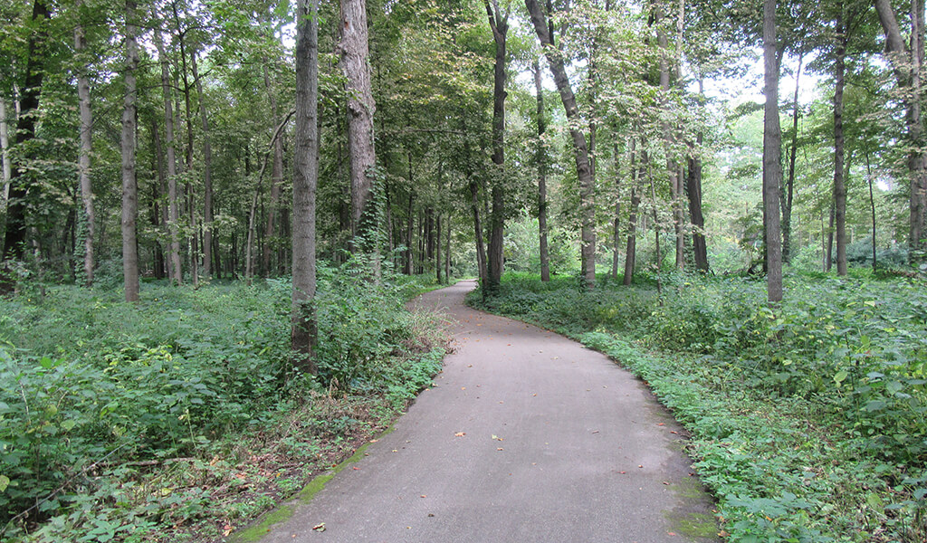
Rail-to-Trail Conversion Provides Unique Recreation Opportunities

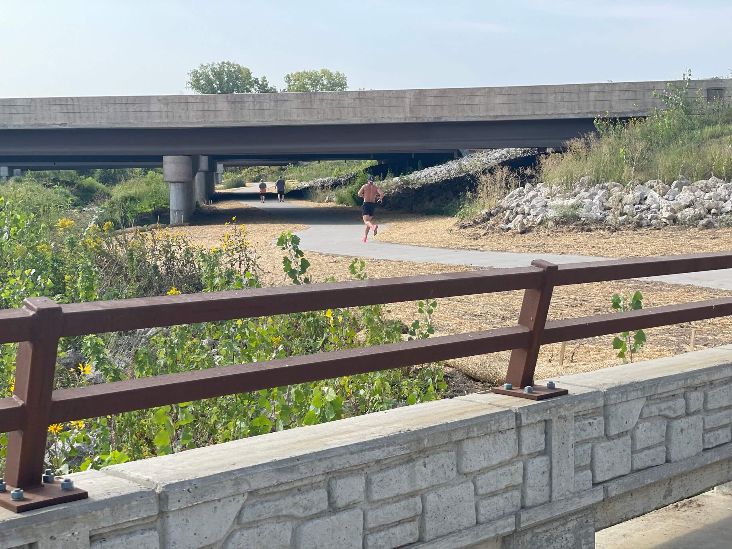
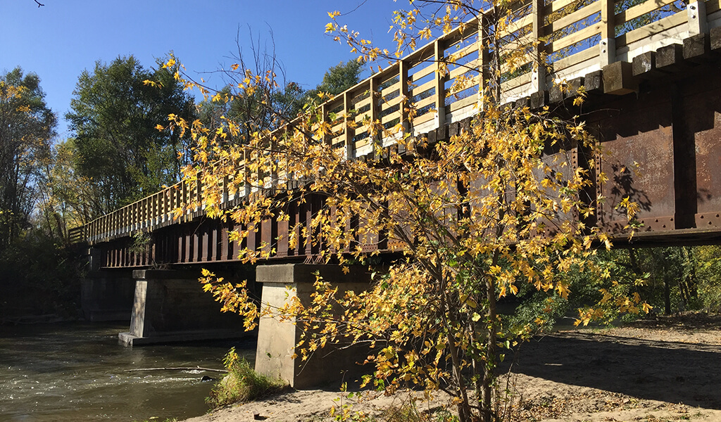
Today, the Allison to Bristow stretch of the Rolling Prairie Trail provides users with access to Wilder Park and restaurants, campsites, and restroom facilities on each end. Trail users experience a variety of landscapes and scenery along the trail, including native prairies, forested canopy, and updated historic railroad bridges. Other trail segments provide access to Wolter’s Prairie Preserve, Heery Woods State Park, and multiple bicycle fix-it stations for unexpected breakdowns. The easy grade of this hard surface trail and the convenient amenities make it a popular destination for outdoor enthusiasts of all ages.

Client

Butler County Conservation Board

Client Type

Project Type

Patrick Schwickerath, P.E.

Patrick Schwickerath, P.E.

Civil / Transportation Engineer

Related Projects

From Des Moines to Carlisle on the Karras-Kaul Connector Trail

Central Iowa’s trail network is expanding with the Carlisle Multi-Use Trail Connection, now known as the Karras-Kaul Connector Trail. Spearheaded by Des Moines city...
A man running on trail underneath bridge|Creek bank underneath bridge|Map of the new Clear Creek Trail alignment around the Interstate 80/380 interchange|Workers install one of the bridges over Clear Creek|Decorative Concrete castings for Clear Creek Trail Connection|Clear Creek Trail connection bridge|Trail underneath bridge in Coralville Iowa

Clear Creek Trail Connection Fills Critical Multi-Modal Gap: Coralville, Iowa

The Clear Creek Trail project has emerged as a significant addition to the ongoing efforts to enhance connectivity and recreational opportunities in Johnson County....
|||Aerial rendering of Hickman and Interstate 35/80 diverging diamond interchange.||Street level rendering of Hickman and Interstate 35/80 diverging diamond interchange.|||Rendering of pedestrian tunnel underneath Interstate 35/80 at Hickman Road diverging diamond interchange.|Bridge abutments design treatment underneath Interstate 35/80 diverging diamond interchange bridge.|||Median treatment rendering underneath Interstate 35/80 diverging diamond interchange bridge.|two pedestrian bridges over the interstate onramps

Progress on the Interstate 35/80 & U.S. 6 Diverging Diamond Interchange Upgrade

The exponential growth of communities, particularly in the western suburbs of Des Moines, has been nothing short of remarkable. The population of Waukee, for example,...
||||

Cedar Heights Drive Reconstruction Continues Cedar Falls Corridor Upgrades

For several years, the Cedar Falls community has been expanding its transportation network along the southern edge of town, including the Greenhill Road corridor. This...
||||||Indian Creek Trail Connection Ribbon Cutting

Indian Creek Trail Connection Unites Key Marion Neighborhoods

Having doubled in population over the past three decades, the Cedar Rapid’s suburb of Marion has been the dual beneficiary of a rapidly expanding metro area and the...
Fixed up railroad bridge into a trail bridge|Summer time light hits the trail bridge and water below|Engineering interns learning how to pave the roads|Shaded trail bridge|Brand new trail bridge with beautiful greenery|Black gated fence around a trail route|Construction happening on a old railroad bridge

River’s Edge Trail Connects Iowa’s Heartland

While it's been many years in the making and still has many miles remaining to construct, the River's Edge Trail is ideally positioned to take advantage of the scenic...
|Prairie City Welcome signage Town Square|Large green plants and trees on either side of a bike trail|Winding trail heads towards a Casey's Gas station|Child bikes a trail through a small town in Iowa|Small town welcome sign with a trail and road next to it|Prairie City town square||

Red Rock Prairie Trail Provides Scenic Recreational Opportunities

Most trail planning in central Iowa over the past two decades has centered around making connections. Whether connecting small communities or social venues, providing...
High Trestle Trail pedestrian bridge at night|Oralabor road trail bridge|Many citizens gathered for a bike ride|Oralabor road trail bridge under construction|The Snyder and Associates Transportation team for Oralabor road trail bridge|Many bicyclists riding along the High Trestle Trail Bridge|Family smiling as they ride across a trail bridge on bikes||||Rich Voelker

Pedestrian Tunnel & Bridge Showcase Trail Extension in Ankeny — High Trestle Trail

Shortly after the High Trestle Trail Bridge over the Des Moines River was completed in 2011, the focus quickly shifted to continuing the trail south through the Ankeny...
Bridge on the Railroad highway trail|Pre-construction of the railroad highway trail|Bridge on the Railroad highway trail|Trail pavement of the Railroad Highway Trail|Map of the Railroad Highway trail

Railroad Highway Trail Connects Western Iowa Communities

Now standing at more than 50% complete, the dream of a completely off-roadway, multi-use trail network spanning the entire country keeps taking steps to becoming...
Thick metal signage with large text|Bicyclist ride past the Council Bluffs fire station|Before construction on First Ave|Bicyclist happily wave at on down the bike trail|First Ave Trail in Council Bluffs|Asphalt trail along high school athletic facilities|Council Bluffs bike trail

First Avenue Trail Creates Council Bluffs Connection

Formally adopted by the City of Council Bluffs in 2015, the West Broadway Corridor Plan was developed to guide the transformation of this busy stretch of roadways into...

more than 45 years

Serving Clients Around the Country

DB+