Lower Skunk River Watershed Management Plan
Stretching across Henry, Jefferson, Lee, and Van Buren counties in southeast Iowa, the Lower Skunk River Watershed is comprised of nearly 135,000 acres. With almost 50 percent of the land in the watershed planted as row crops, the excess nitrogen and phosphorus runoff into local waterways was having a sizable impact on the hypoxic zone where the Mississippi River empties into the northern Gulf of Mexico. This oxygen-deprived “dead zone” represents the second largest hypoxic zone in the world. In 2008, the Gulf Hypoxia Action Plan was created by the Environmental Protection Agency (EPA) which called for Iowa and other states along the Mississippi River to reduce their nutrient loading into the Gulf of Mexico.
This action plan ultimately led to more localized studies and strategies aimed at cleaning up smaller watersheds that were contributing to the greater issue. In an effort to reduce nutrient runoff and improve soil conditions in the Lower Skunk River Watershed, Snyder & Associates was contracted to help investigate conservation practices that would ultimately achieve the targeted goals outlined in the statewide Iowa Nutrient Reduction Strategy. A key component of the strategy included factoring in the guidance and input of farmers, landowners, residents, along with local, state, and federal government agencies.
Recommended Watershed Conservation Practices
To provide a reliable framework for water and soil improvements across the watershed while also maintaining agricultural performance, the Lower Skunk River Watershed Management Plan was formed. This initiative was launched to engage all stakeholders in improving water quality and soil health through a collaborative, research-based approach.
The Snyder & Associates team immediately outlined two primary objectives for the Watershed Management Plan. The first was to review current agricultural conservation methods within the Lower Skunk River Watershed. By recapping the practices already in place, participating members can clearly see which methods are underperforming or lacking and better understand the benefits of the recommended systems. The second objective was to investigate additional conservation practices that would reduce total nitrogen and phosphorous runoff from agricultural fields.
Agricultural Best Management Practices Focus on Erosion Control
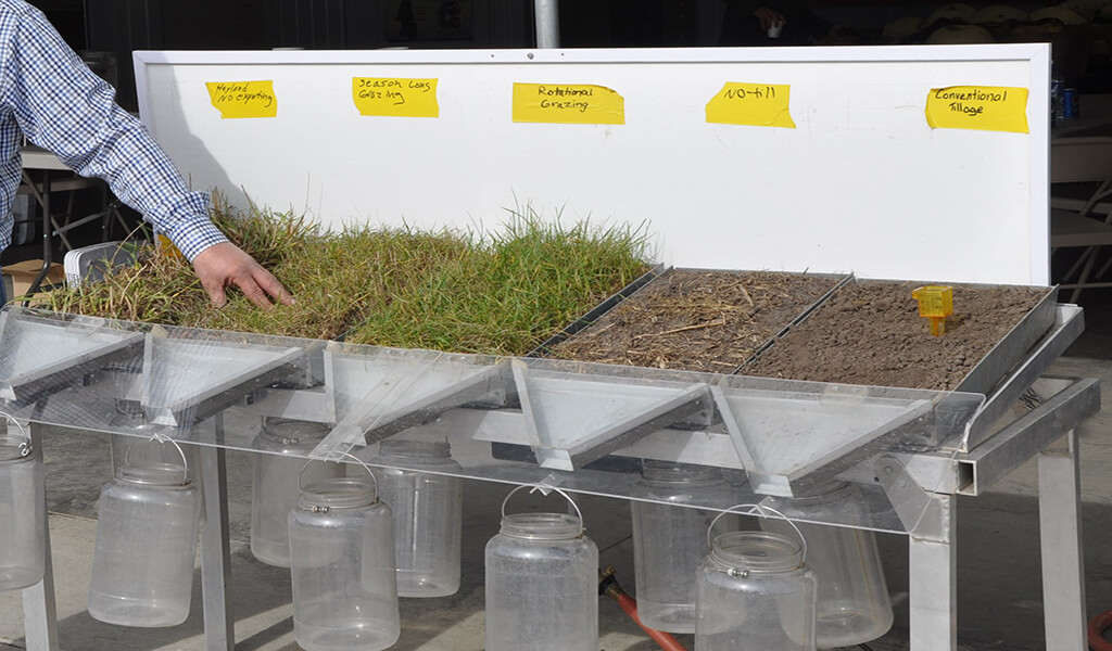
The implementation of Best Management Practices (BMPs) plays a critical role in improving water quality caused by traditional row crop agriculture. Along with reducing nutrient and sediment loads, BMPs can modify the tile drainage outlets and reduce direct surface water runoff. Thorough field investigations performed by our team documented current practices within the assessed corridors. The following practices were found to be used on a stand-alone basis or in combination throughout the watershed:
- No-Till — this technique aims to decrease the amount of soil erosion by avoiding disturbing the soil through tillage.
- Cover Crops — the practice of planting quick-growing plants such as grasses or legumes to keep soil in place after harvest season.
- Crop Rotation — implementing a planting schedule of different crops sequentially on a single plot of land to improve soil health, add nutrients in the soil, and reduce pest and weed issues.
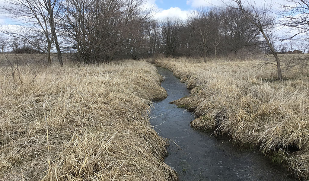
- Saturated Buffer Tile Outlets — tile outlets leading to riparian buffer zones along a waterway rather than outletting directly into the waterway at a single location.
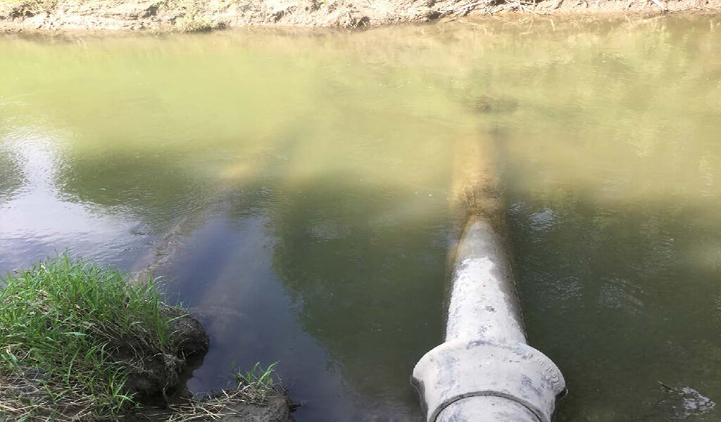
- Bioreactors — tile outlets leading to a buried trench filled with wood chips and water which is then treated within the trench prior to outletting to a waterway.
These practical and effective agricultural conservation practices were selected by management plan participants from the local community as primary focus areas. These methods correlate well with conservation practices that will achieve the Iowa Nutrient Reduction Strategy objectives of a 41 percent reduction in nitrogen and a 29 percent reduction in phosphorus from non-point sources within the next 20 years.
Nitrogen & Phosphorus Nutrient Reduction Key to Plan Success
An in-depth riparian assessment performed by our team identified practices that farmers can cost-share or receive compensation to implement that significantly lower the amount of nutrient loading in the watershed. Designed to improve water quality while sustaining agricultural production, the following nutrient recommendations were presented in three main categories — nitrogen and phosphorous management, land use, and edge-of-field practices:
- Management Practices — highlighting practices such as fertilizer runoff and application rates, timing, and overall method to reduce initial loss.
- Land Use Practices — focusing on long-term changes, including perennial crop and land retirement options to avoid damaging the soil.
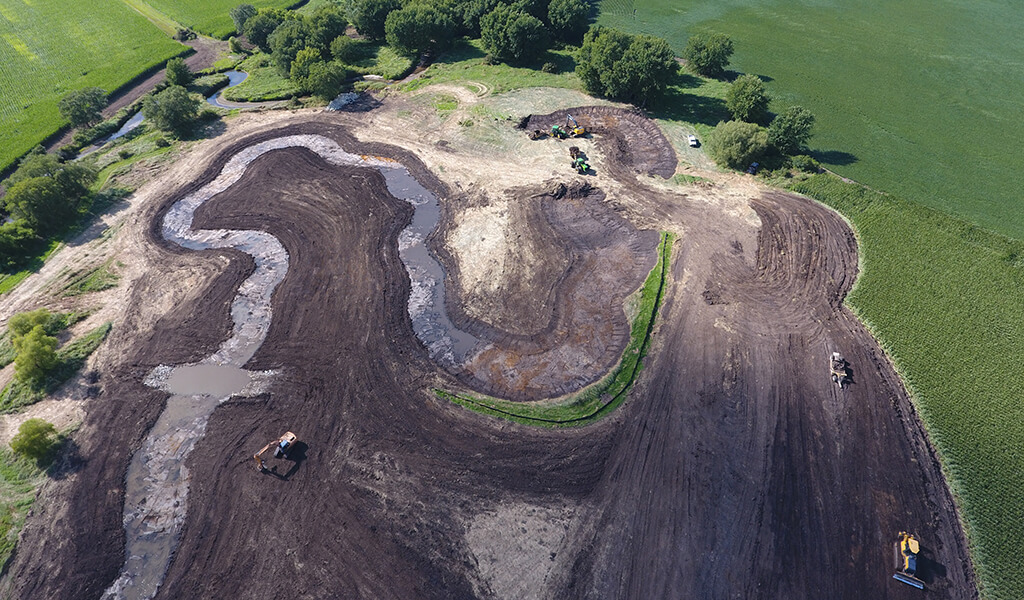
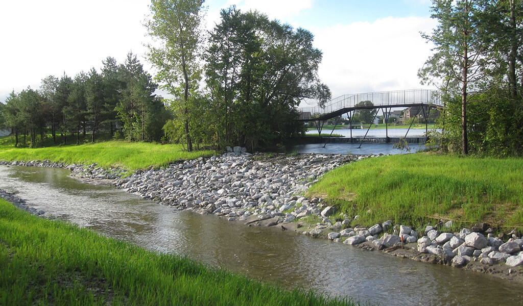
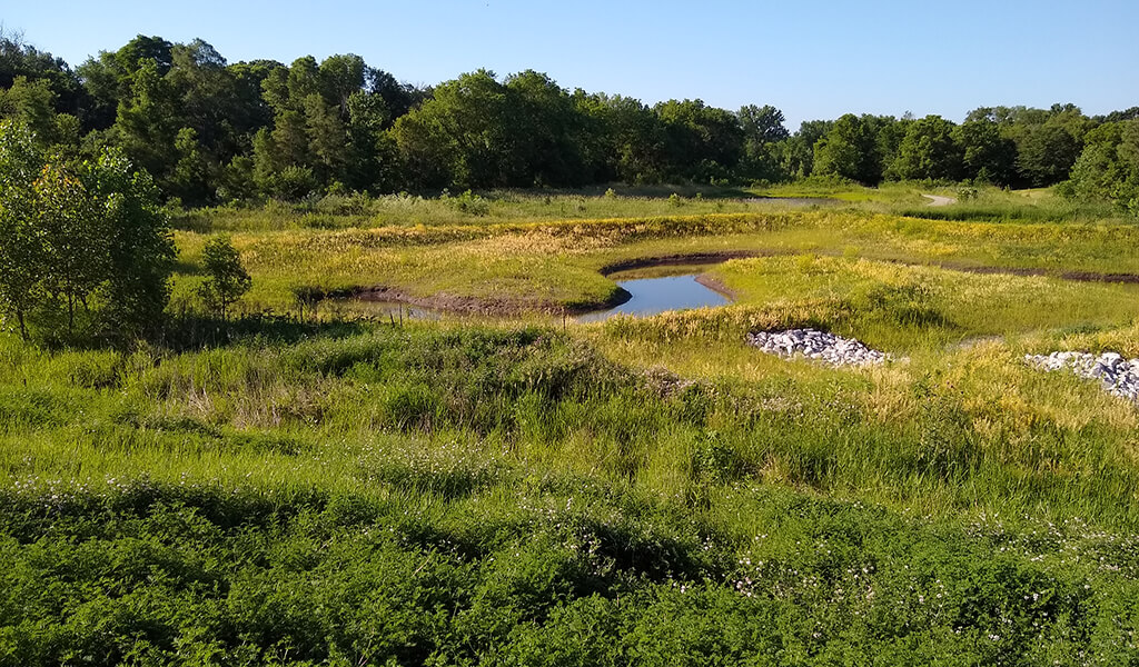
- Edge-of-Field Practices — implementing water drainage management through wetlands, bioreactors, vegetated buffers, saturated buffers, terraces, and sediment control practices.
Perennial energy cover crop is within the top three practices for successful nitrogen reduction and was the most favored alternative by a majority of local agency plan participants. Wetlands, bioreactors, and nutrient management were also among the preferred practices throughout the plan’s feedback sessions.
Continual Improvements toward Clean Agricultural Water
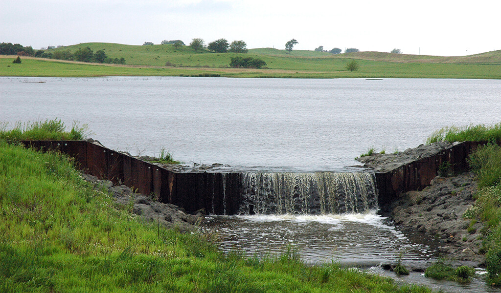
Today, farmer support for the Lower Skunk River Watershed Management Plan has increased nearly two-fold since its inception. There’ve been over 14,000 acres of cover crops implemented, nearly 170,000 feet of terraces built, three alternative tile outlets added, one saturated buffer, one bioreactor, one wetland creation, and three grade-stabilization structures installed. Additionally, one saturated buffer and two-grade stabilization structures are currently in the planning stages.
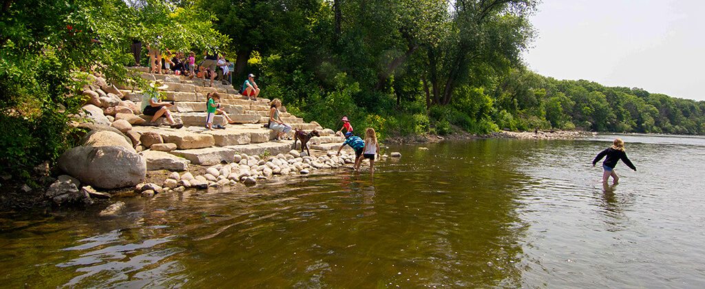
By its very nature, a watershed is influenced by the community whose people share common resources. Decisions regarding the use and implementation of these watershed management practices were heavily influenced by local farmers, landowners, and agency representatives from all counties across the watershed. These decisions guided the development of the watershed plan from start to finish and allowed for significant buy-in from participants. Using a collaborative, research-based approach, this plan aims to continue work with farmers, as well as rural and urban residents to adopt conservation practices that fit their unique needs, lands, and budgets.