2727 SW Snyder Blvd, Ankeny, IA 50023

1 (888) 964-2020


Navigation

Back to Projects | Project Categories: Trails

Railroad Highway Trail Connects Western Iowa Communities

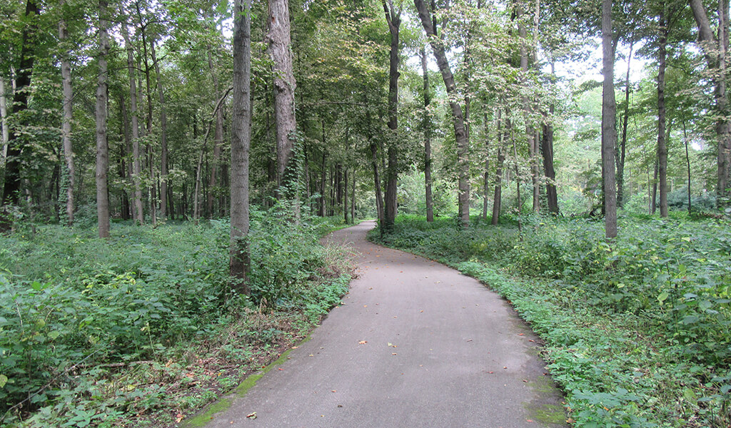
Paving begins on the Railroad Highway Trail.

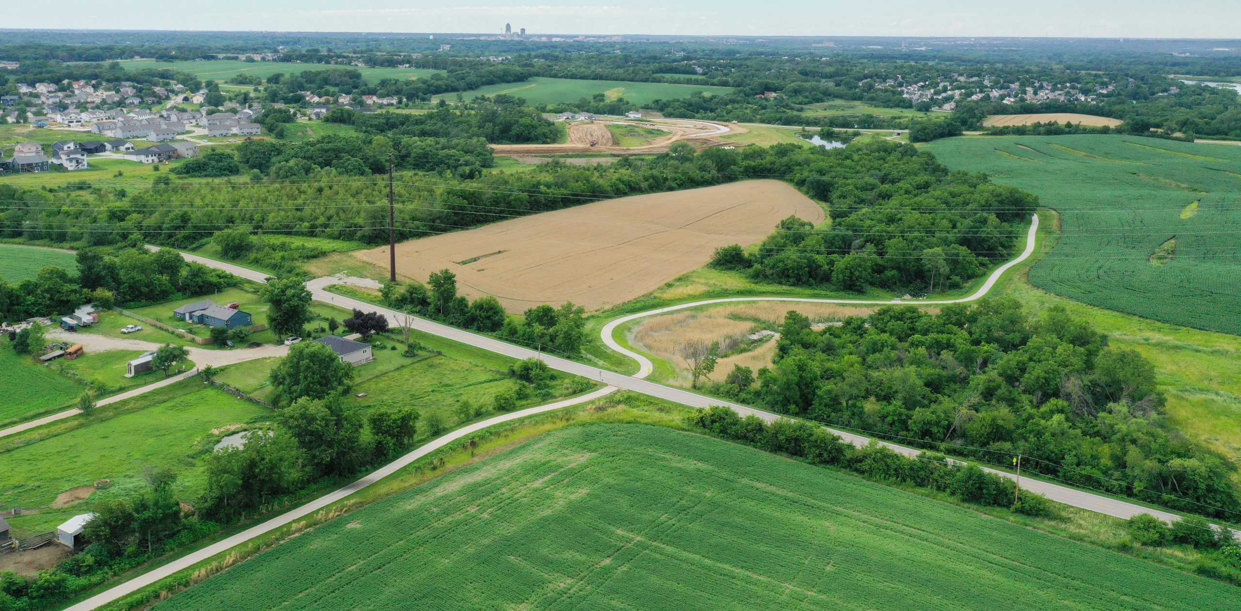
Now standing at more than 50% complete, the dream of a completely off-roadway, multi-use trail network spanning the entire country keeps taking steps to becoming reality. When completed, the Great American Rail Trail will extend over 3,700 miles from Washington D.C. to Washington State. The success of this ambitious project has relied on countless local communities spearheading the construction of their trail sections. In western Iowa, the most recent addition to this trail system includes the Railroad Highway Trail just outside of Council Bluffs.

The trail route will run adjacent to the existing Railroad Highway and when completed, this 10-foot-wide, 15.7-mile-long, hard surface trail will connect Council Bluffs to the communities of Underwood, Weston, and Neola. With significant trail planning, design, funding, and construction experience in Iowa and throughout the Midwest, the Snyder & Associates team was uniquely qualified to assist Pottawattamie County leaders with their plans to connect these rural communities with the Omaha/Council Bluffs area. When finished, the trail will not only fill a significant gap in the Great American Rail Trail, but also provide a conduit for nearby residents to walk, run, or bike through an enjoyable mixture of urban and rural landscapes.

Coordination & In-House Bridge Design Keep the Project Moving

In the early planning stages, our team identified numerous parcels for easement acquisition along the preferred trail route. Twenty-two of those parcels presented right-of-way conflicts that our team began to address with the appropriate entities to prepare the trail path. Since this roadway was previously a state highway that had been jurisdictionally transferred from the Iowa DOT to Pottawattamie County, extensive coordination with the County Engineer’s office and the County GIS Department was crucial in determining what constituted the existing right-of-way line.

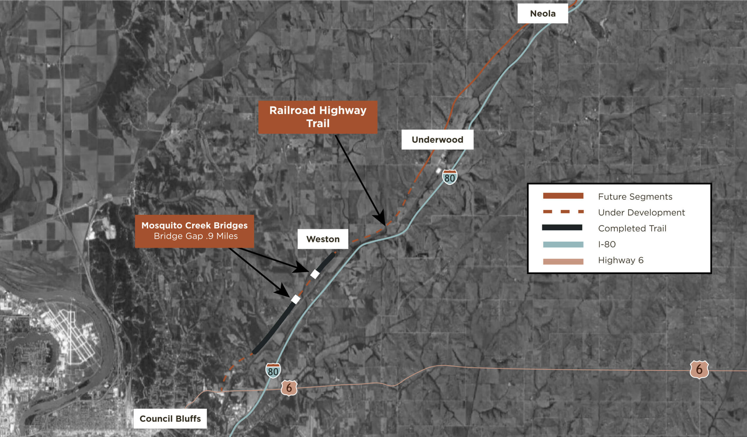
Railroad Highway Trail’s current and planned segments.

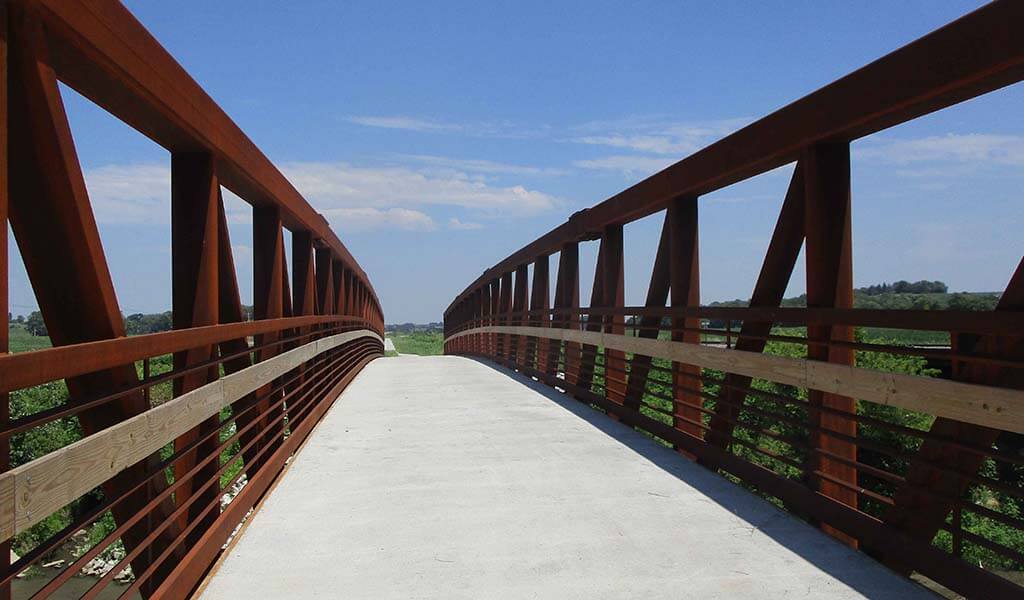
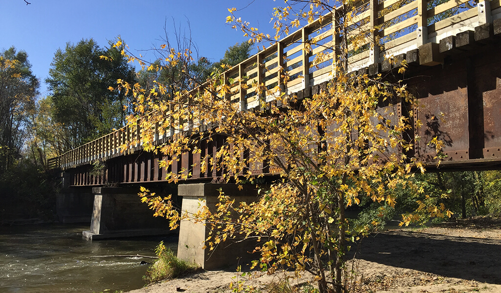
Additionally, the trail route crosses Mosquito Creek at two locations, creating a need for two bridges within one mile of each other. The structural engineers from Snyder & Associates subsidiary, Shuck-Britson, were able to seamlessly step in to prepare detailed plans for each of the bridges and help Pottawattamie County choose the best option. It was determined that prefabricated, truss-style bridges were appropriate to span the 152-foot and 192-foot crossings. To date, the bridges have been installed and a short 0.9-mile stretch of trail between them is currently being designed. Once paved, this “bridge gap” will connect two paved segments for a total of 3.4 continuous miles of trail.

The southernmost segment of the trail from Council Bluffs to Underwood is currently (2022) being designed. Construction of this segment is slated for 2023 and 2024, followed by the final 6.3 miles of the trail from Underwood to Neola.

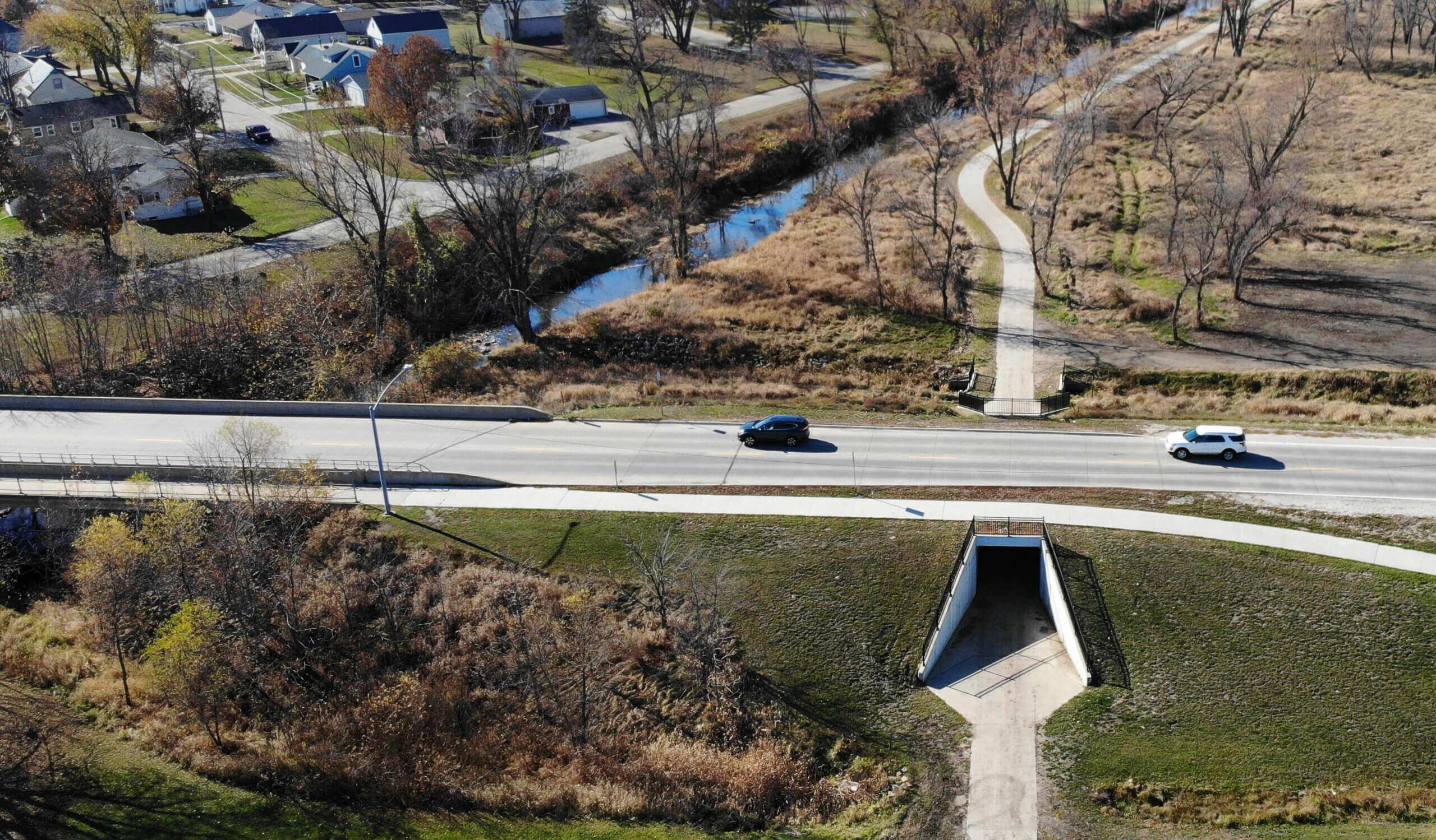
Throughout this project, the Snyder & Associates team has served as the lead planning and design firm, providing preliminary survey, boundary survey, and construction staking, along with our design services for trail alignment, profile design, as well as detailing for the extension and replacement of several box culvert locations along the route.

Trail Funding Sources for the Final Stretch

The keys to success on projects of this magnitude are the identification and utilization of numerous trail funding sources. Our team is uniquely qualified to help find the resources to get the job done. This project has been funded by a diverse collection of grants and donations, including the Omaha-Council Bluffs Metropolitan Area Planning Agency Transportation Alternatives Program (MAPA TAP), the Iowa West Foundation, Iowa DOT’s State Recreational Trail Fund, Pottawattamie County, and the Pottawattamie County Trails Association.

Seeing the Full Picture

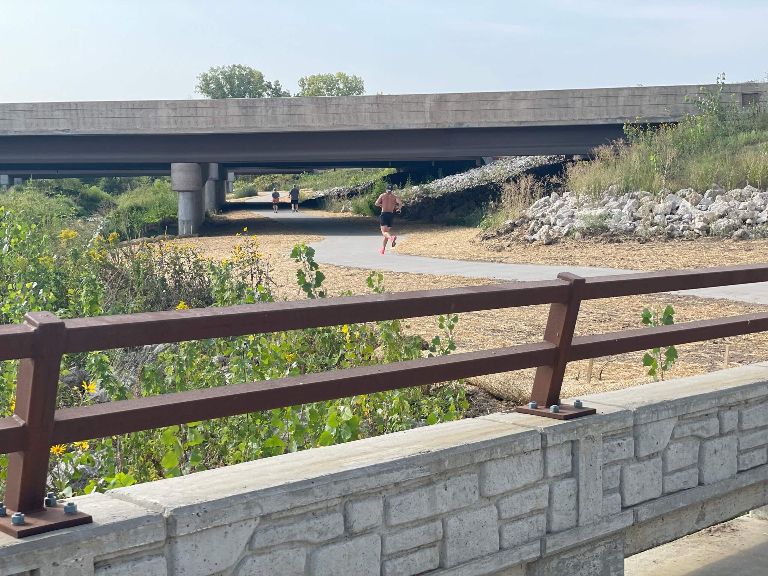
Multi-use trails have been gaining in popularity for decades by bringing benefits to the communities they pass through and the nearby businesses. They can increase the quality of life for residents in a community by providing space for healthy recreation and safe multimodal transportation. Businesses benefit from the increased traffic and awareness of their goods and services. Many rural communities in Iowa and throughout the Midwest have recognized the immense benefits trails have brought to similar communities and have made plans to invest in links to their existing networks.

Once completed the Railroad Highway Trail will join a growing network of hard-surface trails across Iowa, including the well-known High Trestle Trail spanning Story, Boone, and Dallas Counties, the Raccoon River Valley Trail in Dallas County, and the T-Bone Trail connecting Audubon and neighboring Cass County. 

Client

Pottawattamie County

Client Type

Project Type

Michael G. Geier, PLS

Michael G. Geier, PLS

Council Bluffs Business Unit Leader

Related Projects

From Des Moines to Carlisle on the Karras-Kaul Connector Trail

Central Iowa’s trail network is expanding with the Carlisle Multi-Use Trail Connection, now known as the Karras-Kaul Connector Trail. Spearheaded by Des Moines city...
A man running on trail underneath bridge|Creek bank underneath bridge|Map of the new Clear Creek Trail alignment around the Interstate 80/380 interchange|Workers install one of the bridges over Clear Creek|Decorative Concrete castings for Clear Creek Trail Connection|Clear Creek Trail connection bridge|Trail underneath bridge in Coralville Iowa

Clear Creek Trail Connection Fills Critical Multi-Modal Gap: Coralville, Iowa

The Clear Creek Trail project has emerged as a significant addition to the ongoing efforts to enhance connectivity and recreational opportunities in Johnson County....
|||Aerial rendering of Hickman and Interstate 35/80 diverging diamond interchange.||Street level rendering of Hickman and Interstate 35/80 diverging diamond interchange.|||Rendering of pedestrian tunnel underneath Interstate 35/80 at Hickman Road diverging diamond interchange.|Bridge abutments design treatment underneath Interstate 35/80 diverging diamond interchange bridge.|||Median treatment rendering underneath Interstate 35/80 diverging diamond interchange bridge.|two pedestrian bridges over the interstate onramps

Progress on the Interstate 35/80 & U.S. 6 Diverging Diamond Interchange Upgrade

The exponential growth of communities, particularly in the western suburbs of Des Moines, has been nothing short of remarkable. The population of Waukee, for example,...
||||

Cedar Heights Drive Reconstruction Continues Cedar Falls Corridor Upgrades

For several years, the Cedar Falls community has been expanding its transportation network along the southern edge of town, including the Greenhill Road corridor. This...
||||||Indian Creek Trail Connection Ribbon Cutting

Indian Creek Trail Connection Unites Key Marion Neighborhoods

Having doubled in population over the past three decades, the Cedar Rapid’s suburb of Marion has been the dual beneficiary of a rapidly expanding metro area and the...
Fixed up railroad bridge into a trail bridge|Summer time light hits the trail bridge and water below|Engineering interns learning how to pave the roads|Shaded trail bridge|Brand new trail bridge with beautiful greenery|Black gated fence around a trail route|Construction happening on a old railroad bridge

River’s Edge Trail Connects Iowa’s Heartland

While it's been many years in the making and still has many miles remaining to construct, the River's Edge Trail is ideally positioned to take advantage of the scenic...
Bike trail winding through the green forest|Trail with black fencing one either side|Freshly paved trail goes uphill towards a tree line|Incomplete trail bridge|Map of the Rolling Prairie Trail System|Paving underway in the middle of a storm|Trail water drainage

Rolling Prairie Trail Provides Rural Link Across Iowa’s Scenic Landscape

When rail transportation in Iowa peaked in the early 1900s, the state was home to more than 10,500 miles of track. As automobiles became the preferred mode of...
|Prairie City Welcome signage Town Square|Large green plants and trees on either side of a bike trail|Winding trail heads towards a Casey's Gas station|Child bikes a trail through a small town in Iowa|Small town welcome sign with a trail and road next to it|Prairie City town square||

Red Rock Prairie Trail Provides Scenic Recreational Opportunities

Most trail planning in central Iowa over the past two decades has centered around making connections. Whether connecting small communities or social venues, providing...
High Trestle Trail pedestrian bridge at night|Oralabor road trail bridge|Many citizens gathered for a bike ride|Oralabor road trail bridge under construction|The Snyder and Associates Transportation team for Oralabor road trail bridge|Many bicyclists riding along the High Trestle Trail Bridge|Family smiling as they ride across a trail bridge on bikes||||Rich Voelker

Pedestrian Tunnel & Bridge Showcase Trail Extension in Ankeny — High Trestle Trail

Shortly after the High Trestle Trail Bridge over the Des Moines River was completed in 2011, the focus quickly shifted to continuing the trail south through the Ankeny...
Thick metal signage with large text|Bicyclist ride past the Council Bluffs fire station|Before construction on First Ave|Bicyclist happily wave at on down the bike trail|First Ave Trail in Council Bluffs|Asphalt trail along high school athletic facilities|Council Bluffs bike trail

First Avenue Trail Creates Council Bluffs Connection

Formally adopted by the City of Council Bluffs in 2015, the West Broadway Corridor Plan was developed to guide the transformation of this busy stretch of roadways into...

more than 45 years

Serving Clients Around the Country

DB+