
Field Data Collection - Des Moines, IA
Land Survey
Guiding Engineering Success Through Survey
Land surveying plays a critical role in various types of construction projects, including residential developments, large commercial buildings, and industrial complexes. It forms the essential groundwork for project planning, design, and overall success. To ensure prompt and efficient service, we maintain a dedicated survey team spread across the Midwest region. Through close collaboration with project teams, we support contractors, design professionals, and other stakeholders in achieving swift and effective project completion.
Since our establishment in 1977, surveying has remained a fundamental part of our services. Our commitment to every project is not just to meet but exceed client requirements, providing them with sustainable solutions. Our primary focus is on client satisfaction, enabling us to excel in meeting demanding project schedules, even if those requirements evolve during our involvement.
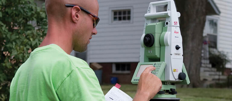
Commitment to Survey Precision Accuracy
We rely on cutting-edge technology, ongoing training, and continuous research and development to ensure that we can deliver precise and detailed data as well as surface models. Our commitment to getting things right from the outset drives us to remain industry leaders, harnessing advanced tools like Trimble and Leica GPS systems, as well as Leica remote control total stations. In addition to these hardware solutions, we utilize specialized software designed for tasks such as GIS data collection, road alignment staking, accurate level runs, and topographic survey work.
Our Land Survey Services
Boundary & Retracement Surveys
Collecting evidence plays a crucial role in re-establishing the boundaries of existing properties. These property lines are determined through a combination of documentation, recorded descriptions, and physical evidence. To ensure the accuracy of locating the original property lines, we collaborate closely with property owners, developers, attorneys, title companies, and governmental offices. This collaborative effort helps us gather the necessary evidence and information for an accurate determination of property boundaries.
ALTA/NSPS Land Survey
We produce ALTA Surveys adhering to the standards established by both the American Land Title Association (ALTA) and the National Society of Professional Surveyors (NSPS). These comprehensive surveys are required for title or mortgage insurance purposes. They offer a detailed overview of the property, encompassing its boundaries, structures (such as buildings and fencing), and any easements present. The objective is to confirm compliance with current zoning regulations.
State DOT Surveys
We tailor our surveying processes to align with the specific requirements of each state, and we provide surveys in their native formats. This approach enables property owners to seamlessly integrate the survey data as if it had been generated by their in-house team. Our goal is to deliver top-notch services that make it feel as though we are an extension of your own staff, ensuring a smooth and effective collaboration.
Topographic Survey & Subsurface Utility Engineering
We utilize the latest advancements in Topographic Survey and Subsurface Utility Engineering technology to create precise and detailed surface models. Our services cater to a wide range of projects, whether they are straightforward or intricate in nature.
Acquisition Plats & Easements
We prioritize optimizing benefits for all involved parties by developing new acquisition plats and clarifying existing easements, which are essential for both public and private utilities and access.
Construction Staking
In the construction staking process, we pay close attention to detail by carefully cross-referencing plan sets with digital/electronic files before commencing construction staking. This meticulous approach ensures both horizontal and vertical accuracy.
UAS/Drone Technology
Our team specializes in leveraging commercial UAS/Drone Technology to enhance our engineering services. This technology allows us to capture high-resolution aerial photography, which complements our conventional survey methods. We use this data to create topographic maps, 3D surface models, point clouds, and geo-referenced true-color orthomosaic imagery. By incorporating these services, your project benefits from increased accuracy, enhanced safety, and cost-effectiveness right from the start.
Aerial Control
Effective mission planning is crucial for successful photogrammetry flights. We recognize the importance of precise ground control targets and easily identifiable points in photos to achieve the best possible results.
Terrestrial 3D Scanning
By employing terrestrial 3D scanners, we can create a precise point cloud with a density tailored to the specific project requirements. This approach enables us to capture intricate details of various elements like external structures, bridges, and the interiors of industrial or commercial spaces. Collecting such detailed information through traditional survey methods would typically take weeks. This level of detail is particularly beneficial for tasks such as building additions, bridge inspections, and remodels.
As-Builts
Confirming that the constructed improvements align with the design plans is a crucial phase in the construction process. Our commitment lies in collaborating with all stakeholders to provide essential, pertinent as-built data in a format that enables the end-user to clearly comprehend what has been built.
Control Networks
It is vital to establish consistent horizontal and vertical control for your city, county, or institution. This ensures that everyone can communicate effectively across various projects and over time. We have implemented control networks for a wide range of sites, spanning from as small as 10 acres to as extensive as entire communities with 50,000 residents.
Flood Mapping/Elevation Certifications/Letter of Map Changes (LOMC)
Flood mapping can be complex, and it’s not always easy for business and residential property owners to grasp its implications. We are here to help you navigate this challenge and understand how it specifically affects your property or site. Once we identify the impact, we will offer guidance on the relevant rules and regulations that apply to your site. If needed, we can also provide solutions to ensure compliance.
Bathymetric Survey
We use a sonar system mounted on either our flat-bottom boat or remote control hydrone to conduct bathymetric surveys. These surveys are carried out to map the underwater terrain of rivers, lakes, and ponds.


