2727 SW Snyder Blvd, Ankeny, IA 50023

1 (888) 964-2020


Navigation

Back to Projects | Project Categories: Development | Trails

Brownfield Site Development: Waunakee Public Library

InBusiness Magazine 2020 Project of the Year, Best New Development or Renovation — Education I AIA Wisconsin 2022 Merit Award for being a “Catalyst project for village economy and life”

Brownfield Site Develops into a New Library

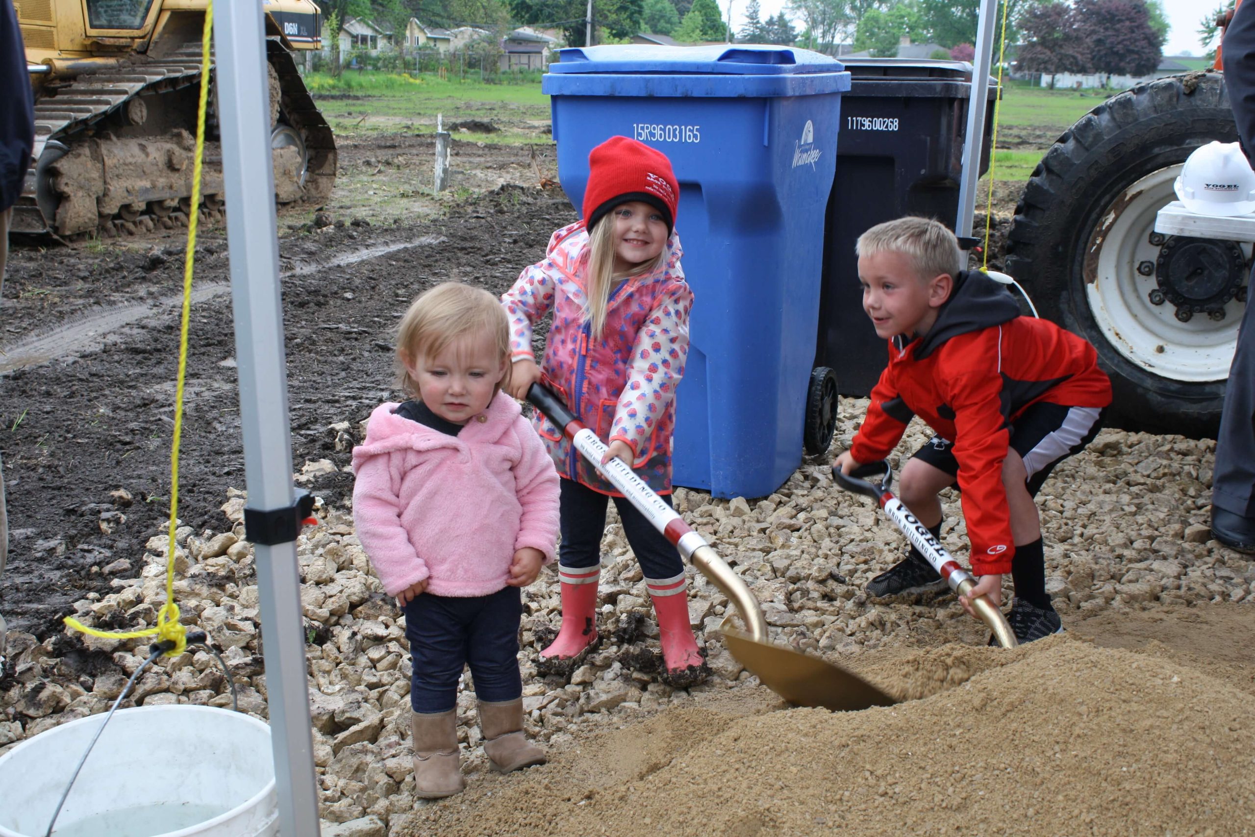
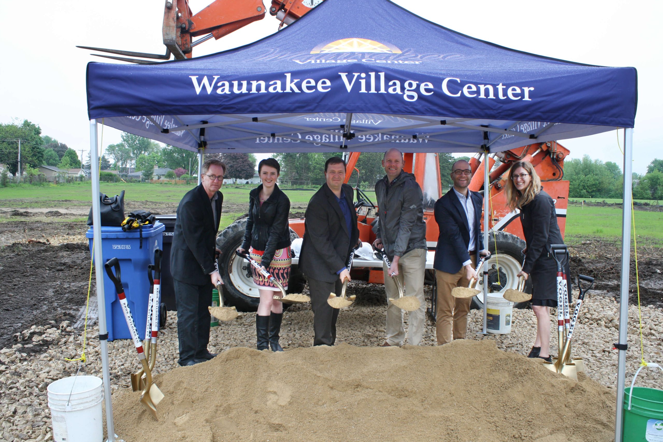
Local children participate in a groundbreaking ceremony for the new Waunakee Public Library on April 21. Photo Credit: Vogel Bros. Building Co.

The Village of Waunakee has been planning for a new library since 2008. After a site search, the village decided on the former Waunakee Alloy Corporation brownfield site, which sits just north of the community’s growing downtown.

A brownfield site is an abandoned industrial property. The land may still contain hazardous contaminants, which can be a deterrent for developers. The United States Environmental Protection Agency (EPA) provides grants and technical assistance to encourage communities, states, and developers to put these blighted properties back into productive use. The Brownfields Program provides support to safely clean up and sustainably reuse contaminated properties under the EPA’s Land Revitalization Program.

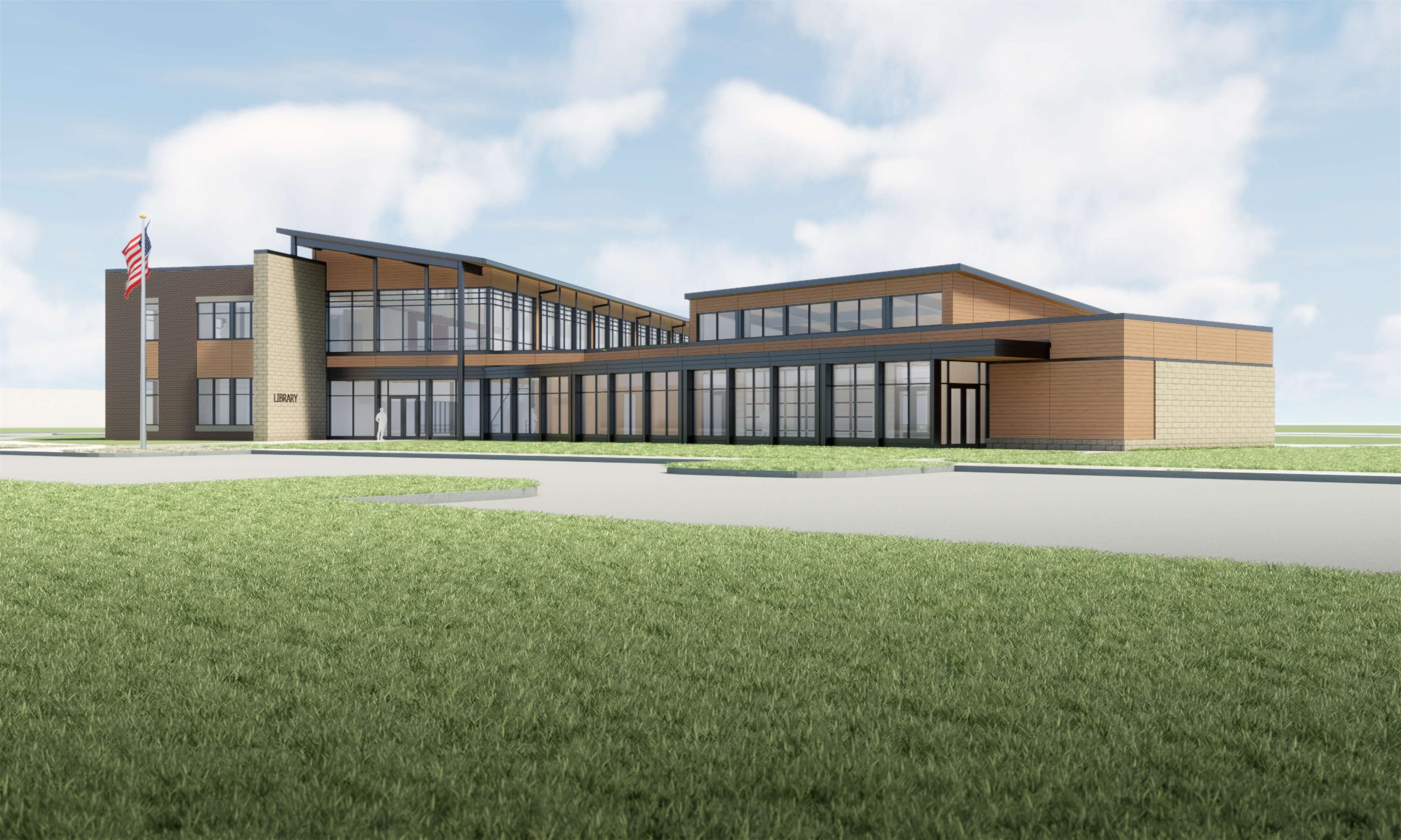
The new Waunakee Public Library is a 40,000-square-foot building designed by OPN with Snyder & Associates handling the site development and utility design, stormwater management, multi-use trail design and planning, a pedestrian bridge, and project permitting. Significant challenges were associated with this project including soil contamination, high groundwater, multiple permitting agencies, and a mapped environmental corridor.

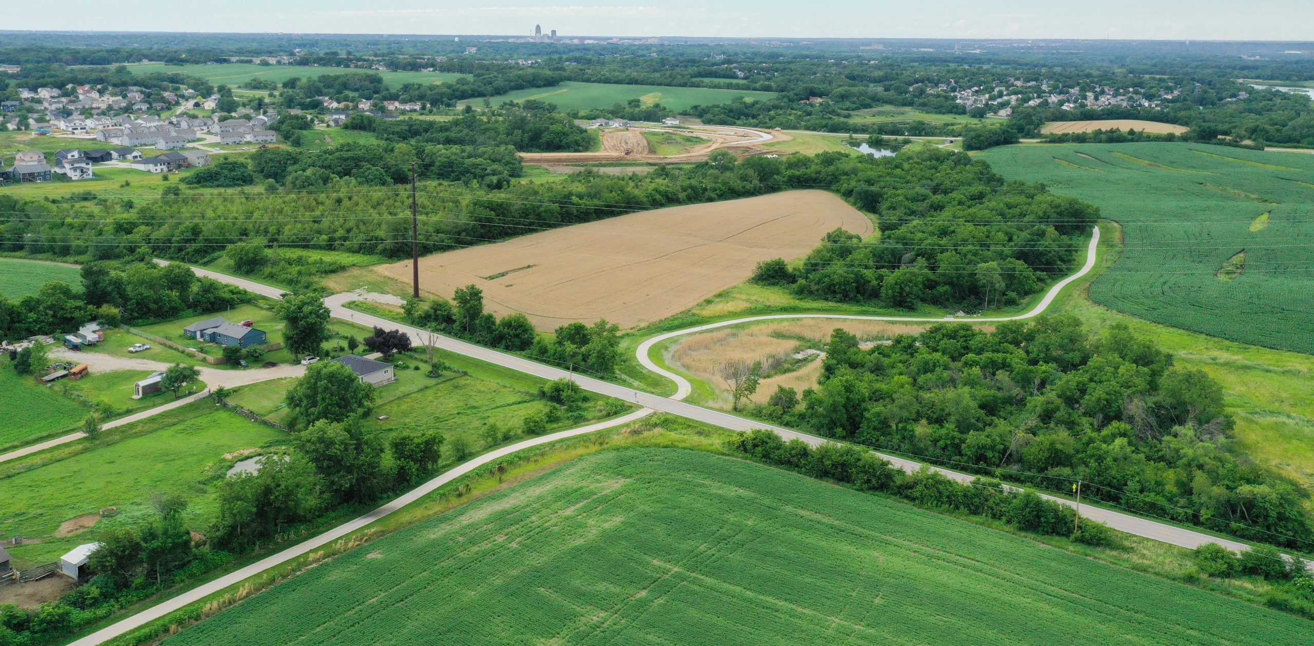
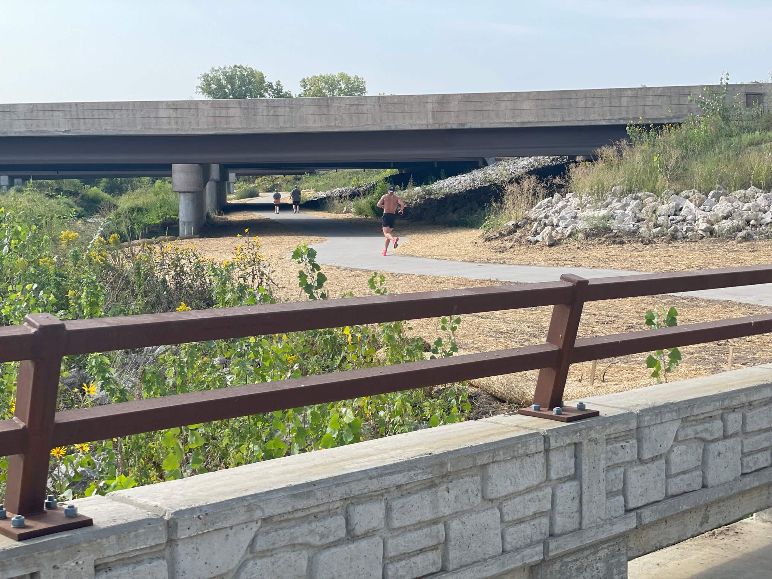
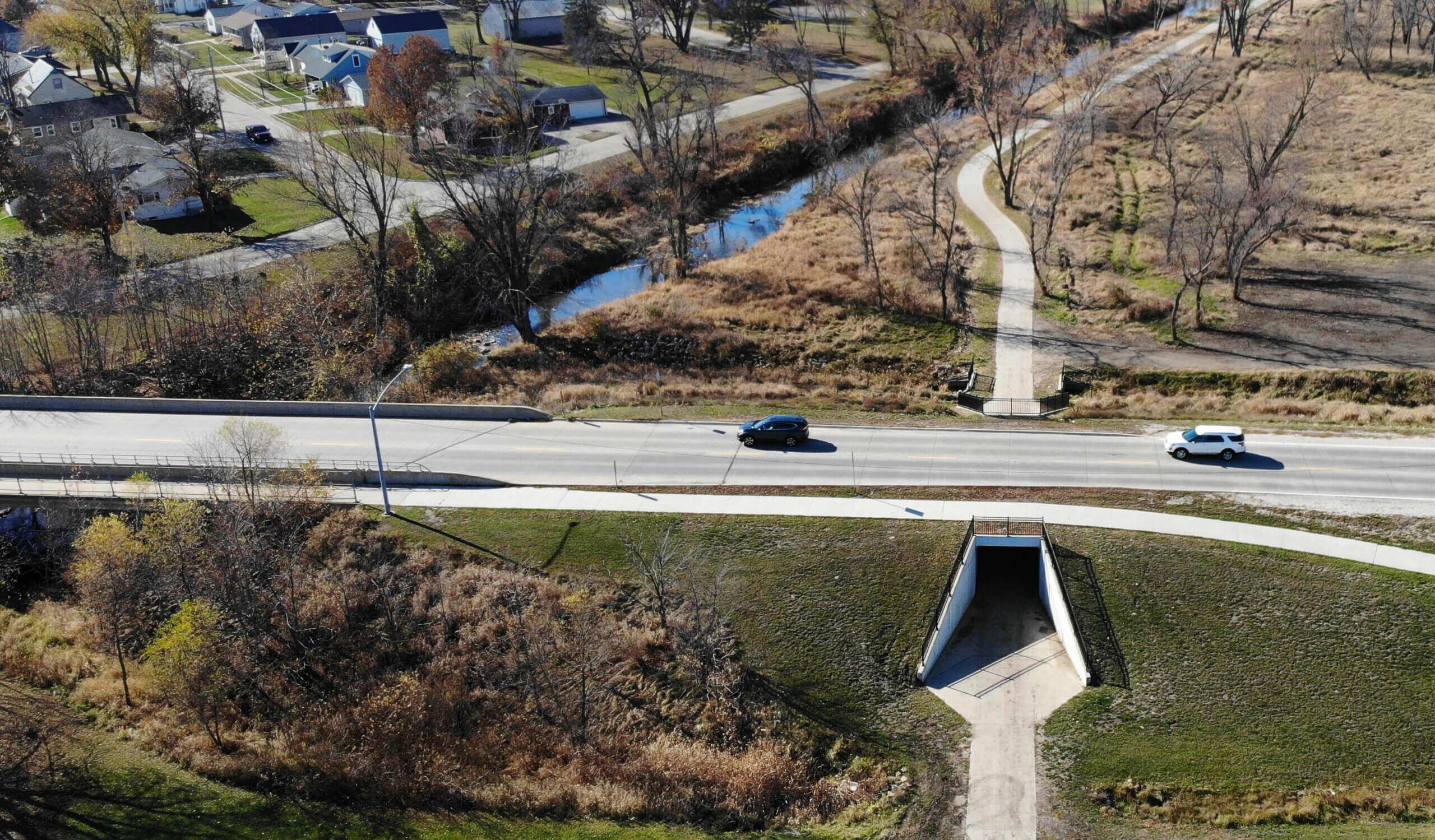
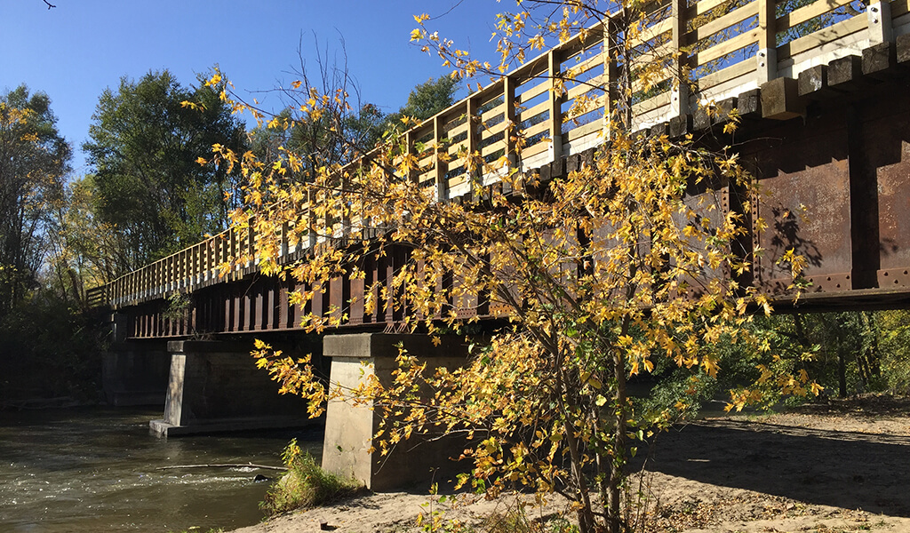
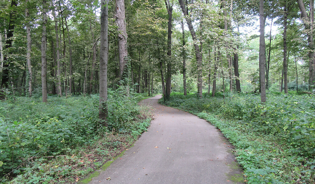
In addition to a new library, the community wanted to promote active transportation and improve connectivity for pedestrians and bicyclists. To facilitate this, a multi-use trail and pedestrian bridge are incorporated into the site design along Sixmile Creek. This 12-foot wide, 900-foot-long paved trail connection will link Pleasant Drive to Madison Street and be located south of the new library on the north side of the creek. The trail will also double as a fire lane. The pedestrian bridge allows patrons to cross Sixmile Creek for access to additional parking on the south side of the site.

Key Achievements

  • Navigated multiple reviewing agencies and permits with long lead times. Finished the design on time with the layout the client desired.
  • Designed the site and trail with less than 10,000 square feet of wetland fill, enabling the project to achieve a general wetland fill permit that was less costly and timely for the Wisconsin Department of Natural Resources (WDNR) permitting process.
  • Site and trail design incorporated the necessary cap required by the WDNR for leaving contaminated soils on-site, which avoided exuberate fees for removing contaminated soil.
  • Designed the site and trail outside of the floodplain line to avoid lengthy FEMA approvals.
  • Incorporated the site and trail design with a 90-foot span pedestrian bridge across Six Mile Creek for access to parking on the south side without affecting the 100-year floodplain.
  • Site design allows for a future building expansion to the west.

Client

Village of Waunakee

Client Type

Project Type

Scott Anderson, P.E.

Scott Anderson, P.E.

Civil Engineer

Related Projects

Site Design & Sustainability Drive Sun Prairie Library Expansion

Snyder & Associates played a central role in the planning and site design for the Sun Prairie Public Library Expansion and Renovation Project. This $26 million...
||||

Creating a Safer, Smarter Space for Animal Services in Des Moines

At the corner of SE 14th and Harriett streets in Des Moines, a forward-thinking facility now stands as a beacon of care for animals and the community. The new Des...

From Des Moines to Carlisle on the Karras-Kaul Connector Trail

2025 Iowa's "Best" Recreational Trails PCC Paving Project awarded by Iowa Concrete Paving Association (ICPA) Central Iowa’s trail network is expanding with the Carlisle...
||

Madison’s First Permanent Men’s Shelter Prioritizes Sustainability & Dignity

For decades, men experiencing homelessness in Madison sought shelter in temporary spaces, often in church basements or emergency accommodations. That will soon change...
A man running on trail underneath bridge|Creek bank underneath bridge|Map of the new Clear Creek Trail alignment around the Interstate 80/380 interchange|Workers install one of the bridges over Clear Creek|Decorative Concrete castings for Clear Creek Trail Connection|Clear Creek Trail connection bridge|Trail underneath bridge in Coralville Iowa

Clear Creek Trail Connection Fills Critical Multi-Modal Gap: Coralville, Iowa

The Clear Creek Trail project has emerged as a significant addition to the ongoing efforts to enhance connectivity and recreational opportunities in Johnson County....
|||Aerial rendering of Hickman and Interstate 35/80 diverging diamond interchange.||Street level rendering of Hickman and Interstate 35/80 diverging diamond interchange.|||Rendering of pedestrian tunnel underneath Interstate 35/80 at Hickman Road diverging diamond interchange.|Bridge abutments design treatment underneath Interstate 35/80 diverging diamond interchange bridge.|||Median treatment rendering underneath Interstate 35/80 diverging diamond interchange bridge.|two pedestrian bridges over the interstate onramps

Progress on the Interstate 35/80 & U.S. 6 Diverging Diamond Interchange Upgrade

The exponential growth of communities, particularly in the western suburbs of Des Moines, has been nothing short of remarkable. The population of Waukee, for example,...
||||

Cedar Heights Drive Reconstruction Continues Cedar Falls Corridor Upgrades

For several years, the Cedar Falls community has been expanding its transportation network along the southern edge of town, including the Greenhill Road corridor. This...
||||||Indian Creek Trail Connection Ribbon Cutting

Indian Creek Trail Connection Unites Key Marion Neighborhoods

Having doubled in population over the past three decades, the Cedar Rapid’s suburb of Marion has been the dual beneficiary of a rapidly expanding metro area and the...
Fixed up railroad bridge into a trail bridge|Summer time light hits the trail bridge and water below|Engineering interns learning how to pave the roads|Shaded trail bridge|Brand new trail bridge with beautiful greenery|Black gated fence around a trail route|Construction happening on a old railroad bridge

River’s Edge Trail Connects Iowa’s Heartland

While it's been many years in the making and still has many miles remaining to construct, the River's Edge Trail is ideally positioned to take advantage of the scenic...
Bike trail winding through the green forest|Trail with black fencing one either side|Freshly paved trail goes uphill towards a tree line|Incomplete trail bridge|Map of the Rolling Prairie Trail System|Paving underway in the middle of a storm|Trail water drainage

Rolling Prairie Trail Provides Rural Link Across Iowa’s Scenic Landscape

When rail transportation in Iowa peaked in the early 1900s, the state was home to more than 10,500 miles of track. As automobiles became the preferred mode of...

more than 45 years

Serving Clients Around the Country

DB+