
Client Name
City of Ankeny, City of Altoona, & Polk County Conservation
Location
Ankeny
Project Type
Services Provided
- ADA Compliance Review & Analysis
- Bicycle & Pedestrian Planning
- Topographic Survey
- Trail Design & Planning
- Wetland & Stream Delineation & Mitigation
Project Manager

Over Two Decades of Planning & Design Culminates in One of the Largest Trail Networks in Central Iowa
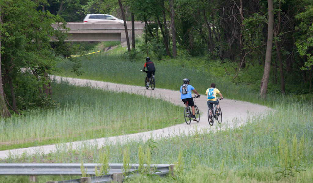
The multi-use recreational trail system in Iowa is one of the crown jewels of the state. Nowhere is the trail system more extensive than in the Des Moines metro area. Most of the communities immediately surrounding Des Moines have at least one trail system within their boundaries. Some have numerous trail spurs that branch off and connects to local destinations.
For more than twenty years, the planners, designers, and engineers from Snyder & Associates have played an active role in the expansion of the Gay Lea Wilson Trail network to the north and east of Des Moines. This trail buildout has found our team working with several different communities, jurisdictions, and agencies on numerous trail section projects.
Altoona Branch of Trail Connects Community
Our relationship with the Gay Lea Wilson Trail kicked off with a nearly two-mile-long section running through the heart of Altoona. This section of trail (later to be renamed the Vern Willey II Trail in honor of the city’s long-time community services director) posed numerous challenges for our trail design team. Chief among them was incorporating the new trail with the existing areas. There were tight locations along the right-of-way, an industrial area that residents didn’t want the trail near, and the plans had to account for a pedestrian bridge and create a railroad track crossing point.

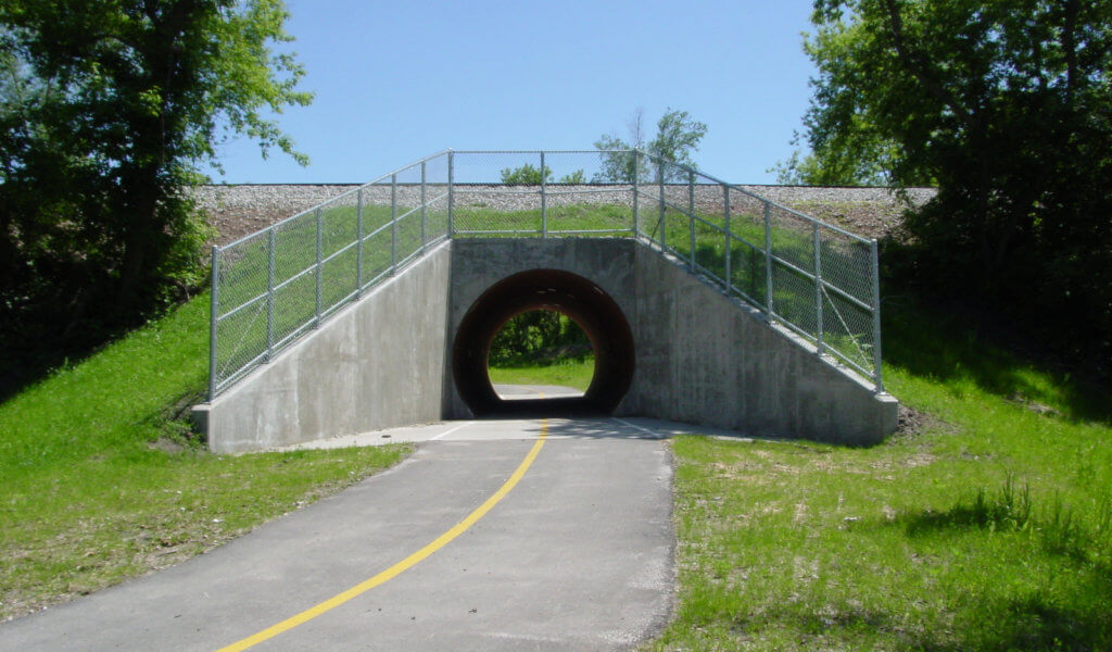
A pneumatic pipe-ramming technique was used to “bore” under the railroad tracks.
The Snyder & Associates engineering team developed a plan to burrow under the railroad tracks using a pneumatic pipe ramming technique. To create a tunnel large enough to accommodate bicyclists, the steel casing used in the process had a massive 147-inch outside diameter, the largest pipe ram project ever completed in the state. This keystone piece of the trail section won an American Council of Engineering Companies (ACEC) of Iowa Honor Award in 2005. The willingness of the engineers to look beyond conventional construction techniques and instead develop a unique, trenchless solution was cited as the key to this trail project’s success.
Phase Two of Gay Lea Wilson Trail Extension Links Altoona to the North
The City of Altoona leaders again partnered with Snyder & Associates to extend the trail network where the Vern Willey II Trail terminates, just north of 1st Street East. This phase two section of the trail resumes as the Gay Lea Wilson Trail and continues to the north side of the city.
As design work began on this new, 1.75-mile trail section, it was clear that numerous challenges would need to be addressed to fit the trail into the existing landscape. The new, 12’-wide HMA trail section initially follows the Iowa Interstate Railroad Line to the northeast. As the trail approaches NE 54th Avenue, however, the design team had to position the trail while accounting for the city’s plans for future roadway reconstruction in the area.
After an at-grade crossing at NE 54th Avenue, the trail turns north and follows NE 80th Street towards the rail line. Crossing the elevated railroad tracks presented another challenge in the trail design. The Iowa Interstate viaduct over NE 80th Street was very narrow and didn’t provide much room for adding the trail. Additionally, an existing triple box culvert passed underneath the roadway and railroad tracks and had to be avoided.

Designers used the existing viaduct to place the trail section.
The design team was able to work within the constraints of the viaduct and placed the new trail section next to the roadway with a concrete barrier rail separating the two. Careful grading work avoided disturbing the box culvert, reducing overall project costs.
From the viaduct, the trail generally follows Mud Creek to the north. Floodplain and wetland considerations required the design team to perform wetland and stream delineations. The multidisciplinary functionality of Snyder & Associates allowed these services to be performed by our in-house environmental scientists.
Streambank stabilization efforts were also necessary along the banks of the Mud Creek oxbows to alleviate future erosion and loss of trail access. The trail alignment was carefully designed to minimize impacts and where unavoidable, these mitigation measures were taken.
For now, this trail section ends at Interstate 80. As land and funds become available, plans call for extending the trail north of the interstate to link up with the Chichaqua Valley Trail near Bondurant. The careful planning by the Snyder & Associates team will allow for the seamless continuation of future trail expansion.
Ankeny Segment Ties Gay Lea Wilson Trail to Regional Network
The Ankeny segments of the trail extended an existing section of the Gay Lea Wilson Trail south of Southeast 54th Street by Carney Marsh. It then meanders to the east, passing under Interstate 35 following an existing railroad line. Extending through a growing subdivision and industrial park area just east of Ankeny, the trail meets up with the Polk County extension at Southeast 29th Street and Southeast Fourmile Drive (more on the Polk County extension shortly).

Following an existing railroad track, the trail passes under Interstate 35 near Ankeny. Photo credit Google Maps.
Completed in two phases, these sections of the trail utilized both abandoned railroad rights-of-way and excess Interstate 35 rights-of-way for portions of the alignment. The remaining alignment was along existing roadway rights-of-way and trail easements. Our team coordinated extensively with the Iowa Department of Transportation (DOT) to work within the Interstate corridor and with the Union Pacific Railroad at the Corporate Woods Drive railroad crossing. Where the trail alignment passed through the new subdivision and industrial park development, close coordination with the developers and their engineers was critical for project success.
The trail’s design along Southeast Fourmile Drive and Southeast 29th Street was complicated by the rural cross-section of the existing road and maintaining adequate drainage provisions. Additionally, there were a series of large utility poles located along the alignment that could not be moved and required creative design solutions to navigate this tricky section.
Polk County Conservation Segment Fills Vital Trail Gap
Constructed simultaneously as the Ankeny branch, the Polk County segment of the Gay Lea Wilson Trail extended the existing recreational trail north along the Fourmile Creek Greenbelt to Northeast 54th Avenue. At Northeast 54th Avenue, the trail alignment turns west and runs adjacent to the existing roadway where it meets the southern end of the Ankeny section at Southeast 29th Street.
This ten-foot-wide trail section is 2.5 miles long and runs through a floodplain with both wetlands and Indiana Bat habitat present. Therefore, the trail alignment was carefully designed to minimize environmental impacts, and where unavoidable, mitigation measures were taken. The Snyder & Associates team provided the preliminary and final design, as well as construction phase services for this entire trail section.
At three difficult bridge locations, our team reviewed the original construction drawings and recognized that the bridges had silted in over many years. An excavation effort at each of the bridge sites re-established the original plan grades and provided enough space for the trail to fit under each bridge without impeding water flows.
While the construction of the Ankeny and Polk County segments of the Gay Lea Wilson Trail filled a vital gap in the Central Iowa Trail Network, our firm’s long-term design efforts have helped to keep all the trail projects moving forward. The Gay Lea Wilson Trail expansion helps to maintain Iowa’s position as a pedestrian, bicyclist, and overall trail-friendly state.