
Client Name
Iowa Department of Transportation
Client Type
Project Type
Services Provided
Project Manager

Highway Widening Project for the Iowa DOT: Corridor Study Leads to Improved Mobility & Reduced Traffic Congestion
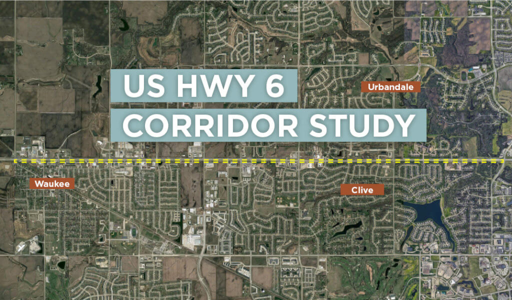
Beginning in the mid-1990’s, the 12-mile section of US Highway 6 extending from Interstate 35/80 to Adel was reconstructed from a two-lane highway to a four-lane divided highway. The plan included an urban section from I-35/80 through the city limits of Waukee, transitioning to a rural expressway from Waukee to Adel. A team of Snyder & Associates transportation engineers designed the new highway which represented our firm’s first major roadway design project for the Iowa Department of Transportation (DOT).
Construction on the widening project was done in several phases and spanned many years, wrapping up in the early 2000s. Policymakers were hoping the expanded corridor would help reduce the congested roadway and spur development in rural Dallas County through improved access and mobility. The project performed beyond all expectations. Dallas County quickly became the fastest growing county in Iowa and the 5th fastest growing county in the nation with a growth rate exceeding 30%.

ASCT systems allow individual signals to communicate with each other to smooth out traffic flow.
The initial traffic study, which led to the highway widening recommendation, predicted 31,000 vehicles per day would be using the corridor by 2029 based on the trend at the time. However, after the reconstruction project was completed, the residential and commercial growth along the corridor accelerated. A subsequent traffic study conducted by Snyder & Associates in 2000 determined the original usage prediction would be realized a full decade sooner than expected.
The initial Highway 6 widening project would eventually lead to over 50 additional projects during the next 20 years to help maintain an acceptable Level of Service (LOS) benchmark along the corridor. These projects included turn lane additions, traffic signal timing upgrades, traffic studies, and multiple other projects.
IDOT “Corridor Master Plan” Adopted by Community Stakeholders
To help manage access to the Highway 6 corridor, in 2003 a Corridor Master Plan was agreed to by the Iowa DOT and the Cities of Urbandale, Clive, and Waukee. The goal of this master plan was to provide guidelines that promote safe and efficient traffic flow to support economic development. The four main guidelines established in the plan include:
- Fully directional access to Highway 6 shall be limited to public road connections at approximately ¼ mile spacing and other predetermined locations. These other locations may be limited to right-in/right-out (RIRO) accesses.
- Accesses shall have necessary turn lanes with appropriate storage, acceleration/deceleration lanes and tapers.
- Developments shall utilize access roads located at least 150′ from the Highway 6 traveled way.
- Traffic signals shall maintain at least ¼ mile spacing, ½ mile preferred.
For the most part, this plan has been followed in the intervening years. Most deviations from the plan were allowed for existing conditions at the time the master plan was adopted.
Current Corridor Study: Recommended Improvements to Improve Traffic Safety & Operation
By 2016, the overwhelming residential and commercial growth along and west of the corridor created a need for another traffic study. Snyder & Associates reviewed 5.5 miles of Highway 6 west of Interstates 35/80, through the cities of Clive, Urbandale, and Waukee. The study included traffic counts (both turning movement and daily counts), crash analysis, existing and future operational analysis, and recommendations for corridor and traffic management strategies. Taking the operation of both signalized and non-signalized intersections into consideration in addition to the rest of the data collected, it was determined that corridor improvements would be necessary.
Traffic volumes are expected to continue growing into the future. Historical traffic trends indicate up to 3% annual growth in Waukee alone, which is the area with the most developable land along the corridor. Annual growth rates were applied to existing traffic volumes to determine geometric needs for each intersection and the overall corridor. Our roadway improvement recommendations included:
- Implementing a single speed limit along the entire corridor to provide consistency. At the time of the study, the speed limit varied from 45 mph to 55 mph.
- Installing permanent, Dynamic Message Signs (DMS) to alert drivers of traffic incidents and corridor conditions. The signs could be operated by the Iowa DOT through their Traffic Operations Center.
Also, the operational analysis indicated that transforming US Highway 6 from four lanes to six lanes would be beneficial for the entire corridor study area. To achieve six through lanes, two options were considered:
- Reducing lane widths from 11’8″ to 11′ and reallocating the existing pavement. The only widening and construction needed would be at intersections requiring additional auxiliary turn lanes and replacement pavement markings. However, this option would locate pavement markings off of joint lines and leave visible scarring from the removal of the existing markings. It would also require drivers to operate their vehicles in the stormwater gutter area during rain events. The storm sewer could remain as originally constructed for most of the corridor.
- Minimal roadway widening to maintain the full, 11’8″ lane width. This option would leave most pavement markings on joint lines. The existing longitudinal storm sewer system would need to be replaced due to the widening.
Both options for converting US Highway 6 to six through lanes can be constructed with minimal traffic impacts. However, each would require widening the bridges over Walnut Creek.
Beyond converting US Highway 6 to six lanes, the study determined that all of the intersections along the corridor would require improvements to operate safely and efficiently in the future. These improvements range from dual left turn and single right turn lanes on all approaches to the installation of traffic signals or movement restrictions at others.
Adaptive Signal Control Technology (ASCT) Considerations
Another option recommended as a result of the study was to convert numerous traffic signals along the corridor to use Adaptive Signal Control Technology (ASCT). This technology uses sensors to gather real-time traffic information and monitor the system’s performance along an entire corridor. This information is quickly evaluated and signal timing improvements are developed by an algorithm. The ASCT implements the updates on a continual basis, sharing information between signals to make adjustments to timing. These constant adjustments accommodate traffic patterns that are different from the peak periods (during which the standard signals were designed to operate) and help keep traffic flowing smoothly.
With standard signals, retiming might only occur every few years and is reliant on time-consuming, manually collected data. Even then, standard time-of-day signal timing plans don’t accommodate for variable and unpredictable traffic patterns. This results in more delays due to congested traffic, excess fuel consumption, and frustrated drivers.
Implementing ASCT along Highway 6 at major intersections beginning at NW 156th Street and moving east into Windsor Heights was highly recommended. The growth along the corridor has been substantial enough that it warrants adding ASCT to improve performance now and in the future.
Funding Assistance Opens Door for more Resources
As part of the corridor study, Snyder & Associates also provided cost opinions with a breakdown of Iowa DOT and local agency cost-sharing options. In addition, we provided a summary of potential funding assistance opportunities. Since completion of the study in 2018, our firm has assisted the Cities of Clive, Urbandale, and Waukee in obtaining Iowa Clean Air Attainment Program (ICAAP) and Transportation Safety Improvement Program (TSIP) funding for improvements to numerous sections of the corridor, including:
- Intersection improvements at US Highway 6 and Alice’s Road beginning in 2019.
- Implementation of Adaptive Signal Control Technology from NW 156th Street to the east beyond Interstate 35/80 in 2019.
- Implementation of Automated Traffic Signal Performance Measures (ATSPM) at several intersections along the corridor in Waukee in 2020. ATSPM is often used as a validation measure before implementing other technologies, like ASCT.
- US Highway 6 & NW 128th Street intersection improvements by 2021.
Maintaining this active and critical roadway is an ongoing effort to meet the needs of an ever-growing region. In conjunction with our firm, all agencies are committed to implementing improvement projects along the corridor as funding becomes available in the future. Snyder & Associates is proud to have been associated with this extensive undertaking for over a quarter of a century — and looks forward to continuing our relationship with the communities and organizations we’ve served.